Oksywie_Wielbark_Przeworsk.gif

Size of this preview:
795 × 600 pixels
.
Other resolutions:
318 × 240 pixels
|
637 × 480 pixels
|
830 × 626 pixels
.

|
This
ethnographic map
image could be re-created
using
vector graphics
as an
SVG
file
. This has several advantages; see
Commons:Media for cleanup
for more information. If an SVG form of this image is available, please upload it and afterwards replace this template with
{{

vector version available

|

new image name

}}
.
It is recommended to name the SVG file “Oksywie Wielbark Przeworsk.svg”—then the template Vector version available (or Vva ) does not need the new image name parameter. |
Summary
| Description |
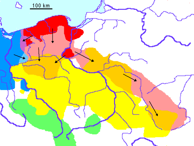
Deutsch:
Oksywiekultur, dann frühe Wielbark-Kultur
Ausweitung der Wielbark-Kultur (2. Jh.)
Jastorfkultur
Przeworsker Kultur
English:
Localization of Oksywie, Wielbark and Przeworsk cultures, drawn after maps showing the single sites, printed in
Reallexikon der Germanischen Altertumskunde
, actual edition:
Oksywie and early Wielbark
later Wielbark
Jastorf
Przeworsk
La Tène culture
(Celtic)
Esperanto:
Kulturo de Oksywie, kaj frua kaj malfrua Kulturo de Wielbark
Ekspansio de la Wielbark-kulturo en la 2a jarcento
Kulturo de Jastorf
Kulturo de Przeworsk
Français :
Culture d'Oksywie, puis première culture de Wielbark
Expansion de la culture Wielbark au IIe siècle
Culture de Jastorf
Culture de Przeworsk
|
| Source | Own work |
| Author | Ulamm |
Licensing
|
|
I, the copyright holder of this work, release this work into the
public domain
. This applies worldwide.
In some countries this may not be legally possible; if so: I grant anyone the right to use this work for any purpose , without any conditions, unless such conditions are required by law. |