Okterritory.png

Size of this preview:
800 × 477 pixels
.
Other resolutions:
320 × 191 pixels
|
640 × 382 pixels
|
1,024 × 611 pixels
|
1,280 × 763 pixels
|
2,515 × 1,500 pixels
.

|
This
locator map
image could be re-created
using
vector graphics
as an
SVG
file
. This has several advantages; see
Commons:Media for cleanup
for more information. If an SVG form of this image is available, please upload it and afterwards replace this template with
{{

vector version available

|

new image name

}}
.
It is recommended to name the SVG file “Okterritory.svg”—then the template Vector version available (or Vva ) does not need the new image name parameter. |
Summary
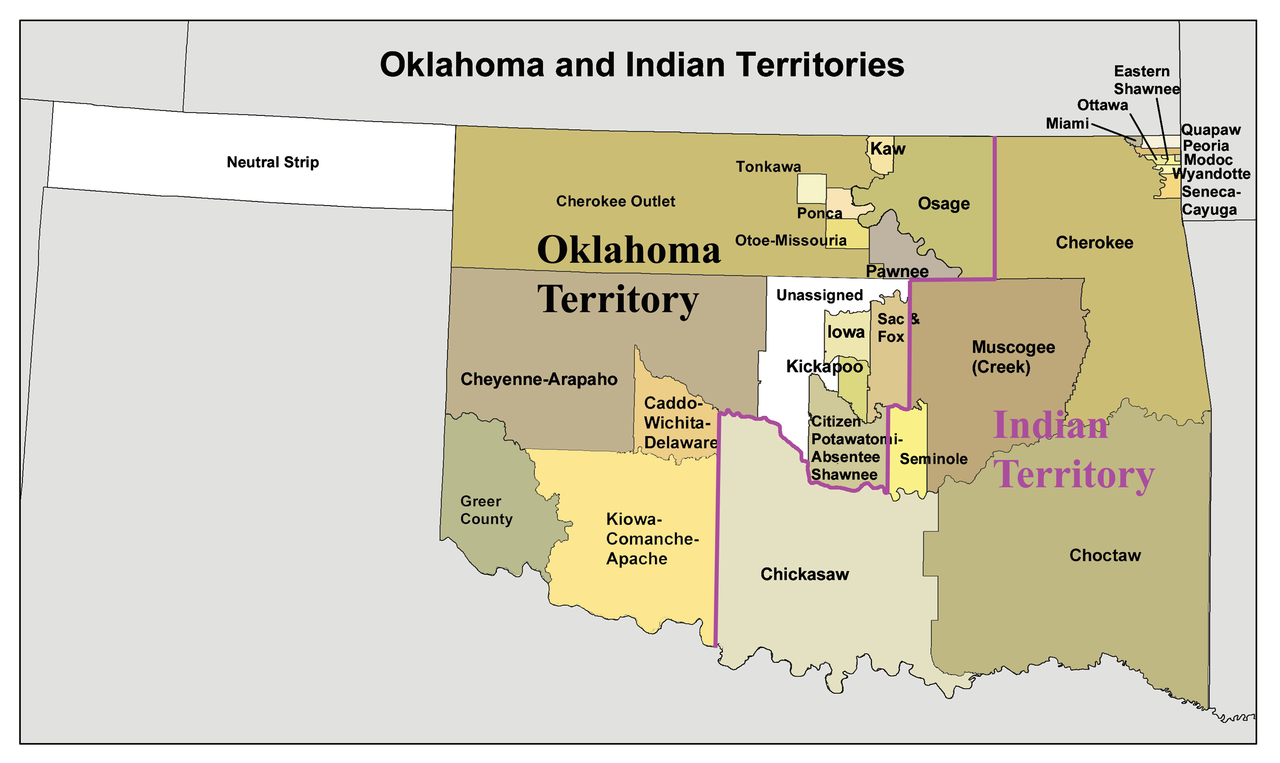
English:
A map of the
Oklahoma Territory
and the reduced
Indian Territory
circa 1890's.
-
- In present day Oklahoma .
- Credits
- I made this using Census Bureau data and this 1892 map as a reference.
Licensing
I, the copyright holder of this work, hereby publish it under the following license:
This file is licensed under the
Creative Commons
Attribution-Share Alike 3.0 Unported
license.
-
You are free:
- to share – to copy, distribute and transmit the work
- to remix – to adapt the work
-
Under the following conditions:
- attribution – You must give appropriate credit, provide a link to the license, and indicate if changes were made. You may do so in any reasonable manner, but not in any way that suggests the licensor endorses you or your use.
- share alike – If you remix, transform, or build upon the material, you must distribute your contributions under the same or compatible license as the original.