Old_Kurdistan_Map,_Ibn_Hawqal.png
Size of this preview:
464 × 600 pixels
.
Other resolutions:
186 × 240 pixels
|
468 × 605 pixels
.
Summary
| Description |
English:
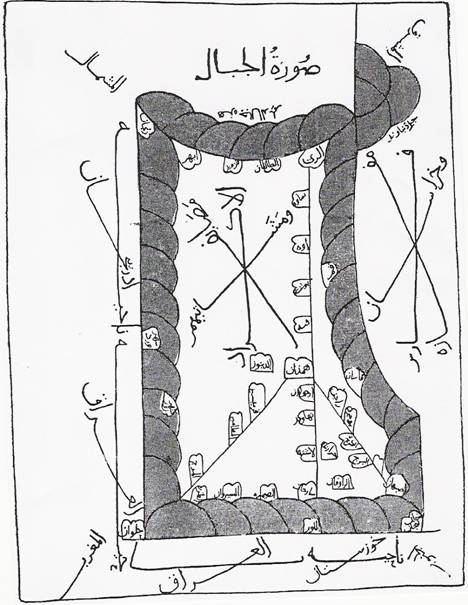
Map of Jibal (Mountains of Eastern/Northern Mesopotamia), Highlighting
Summer and winter resorts of the Kurds", the Kurdish lands, in the middle of the map. From the book Surat al-Ard, 977 AC, by Ibn Hawqal.
العربية:
خريطة الجبال (جبال بلاد ما بين النهرين الشرقية/الشمالية)، تسليط الضوء على المنتجعات الصيفية والشتوية للأكراد، الأراضي الكردية، في وسط الخريطة. من كتاب صورة الأرض لابن حوقل، 977م.
|
| Date | |
| Source | Own work |
| Author | Roboskiye |
Licensing
I, the copyright holder of this work, hereby publish it under the following license:
This file is licensed under the
Creative Commons
Attribution-Share Alike 3.0 Unported
license.
-
You are free:
- to share – to copy, distribute and transmit the work
- to remix – to adapt the work
-
Under the following conditions:
- attribution – You must give appropriate credit, provide a link to the license, and indicate if changes were made. You may do so in any reasonable manner, but not in any way that suggests the licensor endorses you or your use.
- share alike – If you remix, transform, or build upon the material, you must distribute your contributions under the same or compatible license as the original.