This image was
uploaded
in the
JPEG
format even though it
consists of non-photographic data
. This information could be stored more efficiently or accurately in the
PNG
or
SVG
format.
If possible, please upload a PNG or SVG version of this image without
compression artifacts
, derived from a non-JPEG source (or with existing artifacts
removed
). After doing so, please tag the JPEG version with
{{Superseded|NewImage.ext}}
and remove this tag. This tag should not be applied to photographs or scans. If this image is a diagram or other image suitable for
vectorisation
, please tag this image with
{{Convert to SVG}}
instead of
{{BadJPEG}}
. If not suitable for vectorisation, use
{{Convert to PNG}}
. For more information, see
{{BadJPEG}}
.
This map has been uploaded by
Electionworld
from en.wikipedia.org to enable the
Wikimedia
Atlas of the World
. Original uploader to
en.wikipedia.org
was
Lupo
, known as
Lupo
at en.wikipedia.org. Electionworld is not the creator of this map. Licensing information is below.
Permission is granted to copy, distribute and/or modify this document under the terms of the
GNU Free Documentation License
, Version 1.2 or any later version published by the
Free Software Foundation
; with no Invariant Sections, no Front-Cover Texts, and no Back-Cover Texts. A copy of the license is included in the section entitled
GNU Free Documentation License
.
http://www.gnu.org/copyleft/fdl.html
GFDL
GNU Free Documentation License
true
true
to share
– to copy, distribute and transmit the work
to remix
– to adapt the work
Under the following conditions:
attribution
– You must give appropriate credit, provide a link to the license, and indicate if changes were made. You may do so in any reasonable manner, but not in any way that suggests the licensor endorses you or your use.
share alike
– If you remix, transform, or build upon the material, you must distribute your contributions under the
same or compatible license
as the original.
This licensing tag was added to this file as part of the GFDL
licensing update
.
http://creativecommons.org/licenses/by-sa/3.0/
CC BY-SA 3.0
Creative Commons Attribution-Share Alike 3.0
true
true
Captions
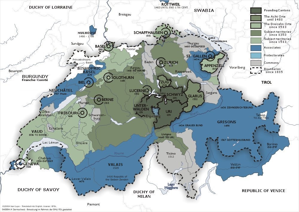
The Old Swiss Confederacy from 1291 (dark green) to the sixteenth century (light green) and its associates (blue). In the other colours shown are the subject territories.


