Operation25yu.jpg

Size of this preview:
689 × 599 pixels
.
Other resolutions:
276 × 240 pixels
|
552 × 480 pixels
|
883 × 768 pixels
|
1,177 × 1,024 pixels
|
1,775 × 1,544 pixels
.
Summary
| Description |
English:
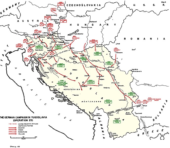
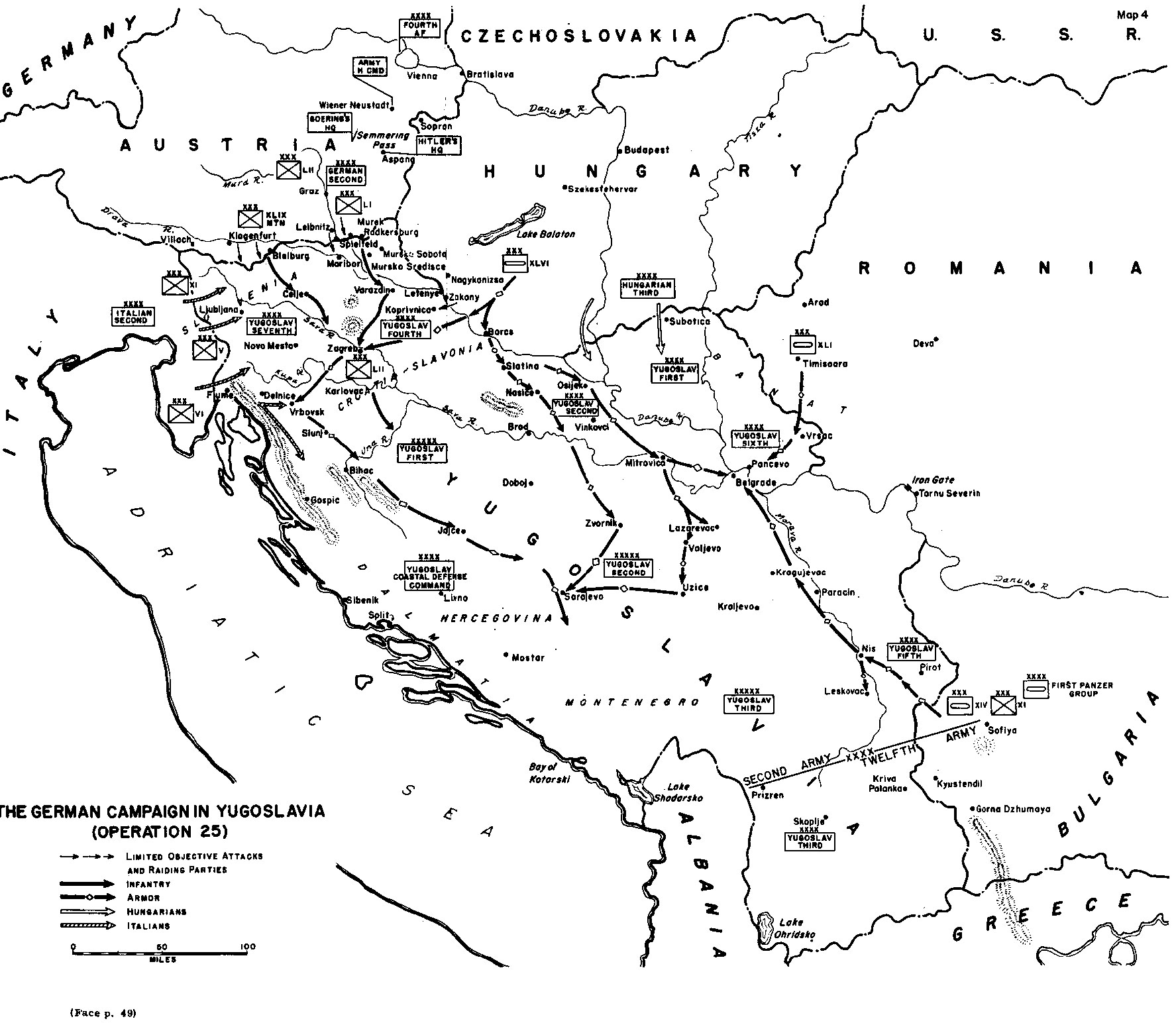
A black and white map showing the Axis invasion of Yugoslavia in April 1941
|
| Date | |
| Source | http://www.army.mil/cmh-pg/books/wwii/balkan/Maps/4.jpg |
| Author | US Army |

|
File:Map of invasion of Yugoslavia - Situation map.svg
is a vector version of this file. It should be used in place of this JPG file when not inferior.
File:Operation25yu.jpg →
File:Map of invasion of Yugoslavia - Situation map.svg
For more information, see
Help:SVG
.
|

|
Licensing
|
|
This file is a work of a
U.S. Army
soldier or employee, taken or made as part of that person's official duties. As a
work
of the
U.S. federal government
, it is in the
public domain
in the United States.
|

|
derivative works
Derivative works of this file: InvasiónDeYugoslaviaAbrilDe1941.svg