Operação_Hymenaea,_Julho-2016_(29399454651).jpg

Size of this preview:
800 × 533 pixels
.
Other resolutions:
320 × 213 pixels
|
640 × 427 pixels
|
1,024 × 683 pixels
|
1,280 × 853 pixels
|
3,000 × 2,000 pixels
.
Summary
| Description |
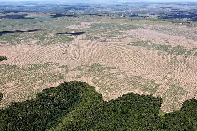
Ibama and the Federal Police are fighting a criminal group responsible for illegally extracting and trading wood from the Gurupi Biological Reserve and the Caru and Alto Turiaçu Indigenous Lands, in Maranhão. Translated, original text below: Ibama e Polícia Federal combatem grupo criminoso responsável por extrair e comercializar ilegalmente madeira da Reserva Biológica do Gurupi e das Terras Indígenas Caru e Alto Turiaçu, no Maranhão. Photo: Felipe Werneck - Ascom/Ibama |
| Date | |
| Source | Operação Hymenaea, Julho/2016 |
| Author | Ibama from Brasil |
| Camera location |
|
View this and other nearby images on: OpenStreetMap |
|
|---|
.jpg¶ms=-04.706414_N_-046.820663_E_globe:Earth_type:camera_source:Flickr_&language=en)
Licensing
This file is licensed under the
Creative Commons
Attribution 2.0 Generic
license.
-
You are free:
- to share – to copy, distribute and transmit the work
- to remix – to adapt the work
-
Under the following conditions:
- attribution – You must give appropriate credit, provide a link to the license, and indicate if changes were made. You may do so in any reasonable manner, but not in any way that suggests the licensor endorses you or your use.
|
|
This image was originally posted to Flickr by Ibamagov at https://flickr.com/photos/145872537@N06/29399454651 . It was reviewed on 24 September 2016 by FlickreviewR and was confirmed to be licensed under the terms of the cc-by-2.0. |