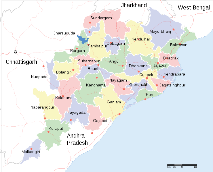
Orissa_State_map.svg

Size of this PNG preview of this SVG file:
740 × 599 pixels
.
Other resolutions:
296 × 240 pixels
|
593 × 480 pixels
|
948 × 768 pixels
|
1,264 × 1,024 pixels
|
2,529 × 2,048 pixels
|
2,184 × 1,769 pixels
.
Summary
| Title |
English:
Locator map of Indian state, Odisha.
|
| Description |
Locator map of the state of Orissa,
India
with district boundaries.
|
| Date | |
| Source |
Own work
|
| Creator | |
|
Permission
( Reusing this file ) |
I, the copyright holder of this work, hereby publish it under the following license:
This file is licensed under the
Creative Commons
Attribution-Share Alike 3.0 Unported
license.
|
| Geotemporal data | |
| Date depicted | second half of 20 th century and 21 st century |
| Georeferencing | If inappropriate please set warp_status = skip to hide. |
| Archival data | |
| Notes | Part of WikiProject India Maps |
| Other versions |
[
]
|


