Ottawagreenbelt.PNG
No higher resolution available.
Summary
| Description |
English:
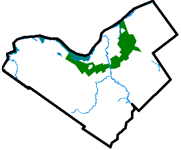
The city of Ottawa, located in the middle of the map, is surrounded by the Ottawa Greenbelt. Greenbelt surrounding Ottawa, Ontario (1950).
Français :
La ceinture de verdure autour d'Ottawa.
Simple English:
The city of Ottawa, located in the middle of the map, is surrounded by the Ottawa Greenbelt.
|
||
| Date | 1 February 2005 (original upload date) | ||
| Source | Transferred from en.wikipedia to Commons. | ||
| Author |
|
||
| Other versions |
|

Licensing
|
|
This work has been released into the
public domain
by its author,
Earl Andrew
at
English Wikipedia
. This applies worldwide.
In some countries this may not be legally possible; if so: Earl Andrew grants anyone the right to use this work for any purpose , without any conditions, unless such conditions are required by law. |
Original upload log
The original description page was
here
. All following user names refer to en.wikipedia.
- 2005-02-01 07:13 Earl Andrew 358×297×8 (7460 bytes) {{PD-self}}