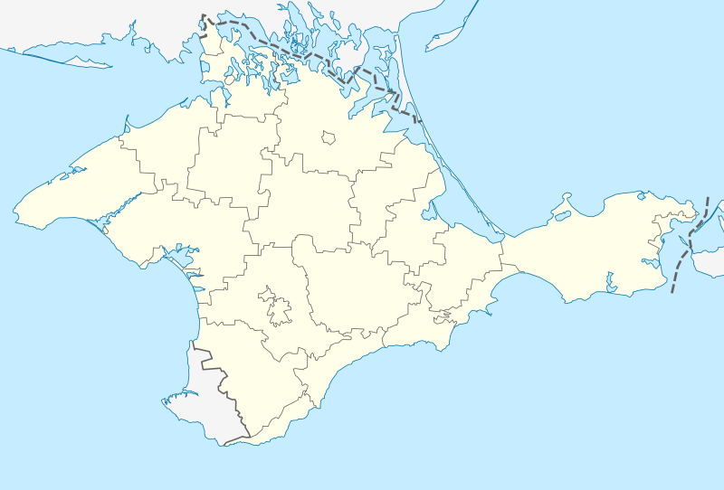
Outline_Map_of_Crimea_(disputed_status).svg

Size of this PNG preview of this SVG file:
800 × 542 pixels
.
Other resolutions:
320 × 217 pixels
|
640 × 434 pixels
|
1,024 × 694 pixels
|
1,280 × 868 pixels
|
2,560 × 1,736 pixels
|
1,000 × 678 pixels
.

|
The boundaries on this map show the de facto situation. This is just one of several different views on the subject (see COM:NPOV ). |
Summary
| Description |
Deutsch:
Positionskarte der umstrittenen
Autonomen Republik Krim
(Ukraine)/
Republik Krim
(Russland)
English:
Location map of the disputed
Autonomous Republic of Crimea
(Ukraine)/
Republic of Crimea
/Russia
Conformal projection, standard parallels — 45°15's.W. Template parameters (coordinates of the edges):
|
| Date | |
| Source |
|
| Author | NordNordWest |
| Other versions |
Derivative works of this file: Relief map of Crimea.jpg |
Licensing
|
|
I, the copyright holder of this work, release this work into the
public domain
. This applies worldwide.
In some countries this may not be legally possible; if so: I grant anyone the right to use this work for any purpose , without any conditions, unless such conditions are required by law. |