PIA17202_-_Approaching_Enceladus.jpg
Size of this preview:
600 × 600 pixels
.
Other resolutions:
240 × 240 pixels
|
480 × 480 pixels
|
1,020 × 1,020 pixels
.
Summary
| Description |
English:
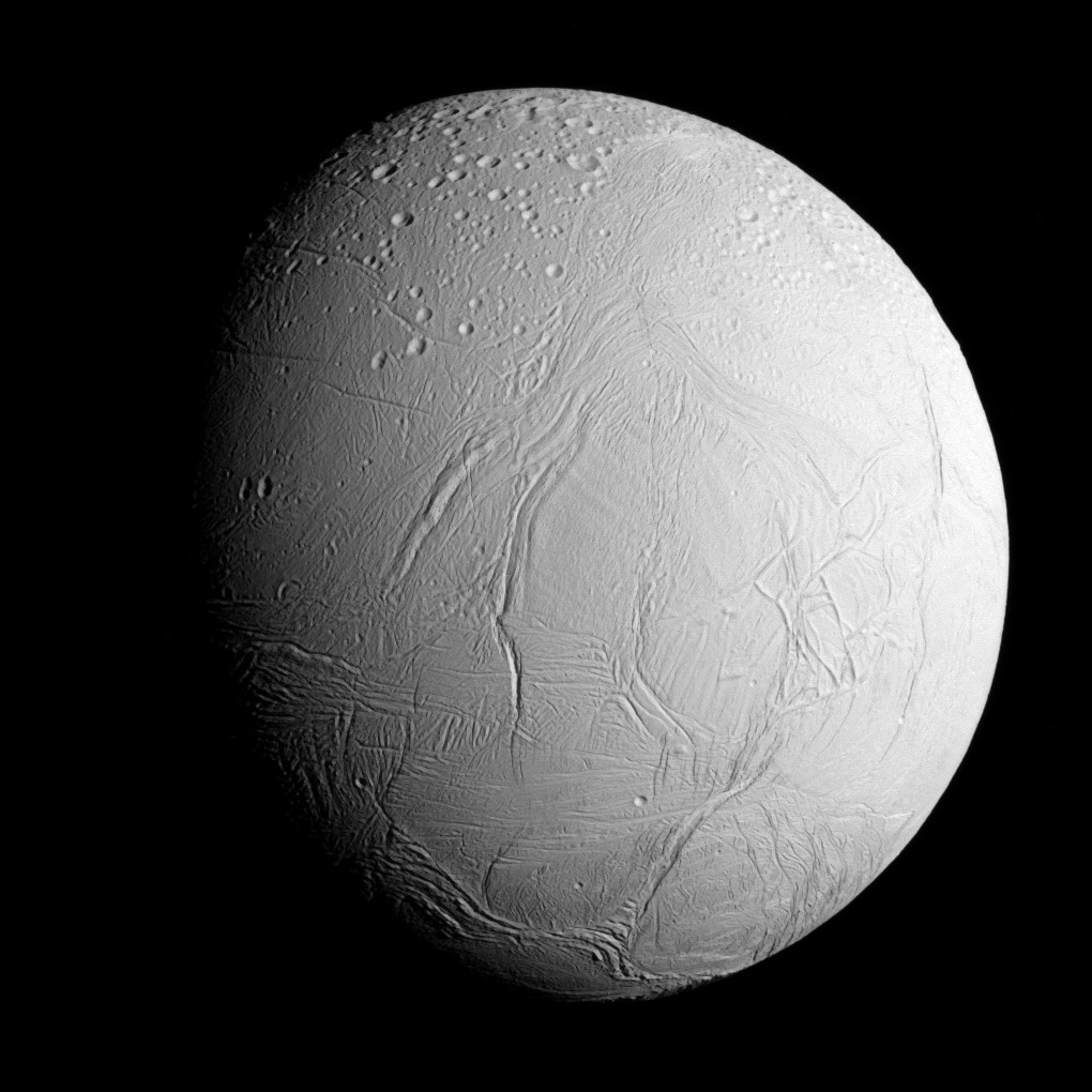
Original caption:
NASA's Cassini spacecraft captured this view as it neared icy Enceladus for its closest-ever dive past the moon's active south polar region. The view shows heavily cratered northern latitudes at top, transitioning to fractured, wrinkled terrain in the middle and southern latitudes. The wavy boundary of the moon's active south polar region -- Cassini's destination for this flyby -- is visible at bottom, where it disappears into wintry darkness.
This view looks towards the Saturn-facing side of Enceladus. North on Enceladus is up and rotated 23 degrees to the right. The image was taken in visible light with the Cassini spacecraft narrow-angle camera on Oct. 28, 2015. The view was acquired at a distance of approximately 60,000 miles (96,000 kilometers) from Enceladus and at a Sun-Enceladus-spacecraft, or phase, angle of 45 degrees. Image scale is 1,896 feet (578 meters) per pixel. |
| Date | |
| Source | PIA17202 from the NASA/JPL Photojournal |
| Author | National Aeronautics and Space Administration (NASA) / Jet Propulsion Laboratory (JPL) |
Licensing
|
|
This file is in the public domain in the United States because it was solely created by NASA . NASA copyright policy states that "NASA material is not protected by copyright unless noted ". (See Template:PD-USGov , NASA copyright policy page or JPL Image Use Policy .) |
|

|
Warnings:
|