PIA19411-Mercury-WaterIce-Radar-MDIS-Messenger-20150416.jpg

Size of this preview:
800 × 436 pixels
.
Other resolutions:
320 × 174 pixels
|
640 × 349 pixels
|
1,024 × 558 pixels
|
1,280 × 697 pixels
|
2,560 × 1,395 pixels
|
4,000 × 2,179 pixels
.
Summary
| Description |
English:
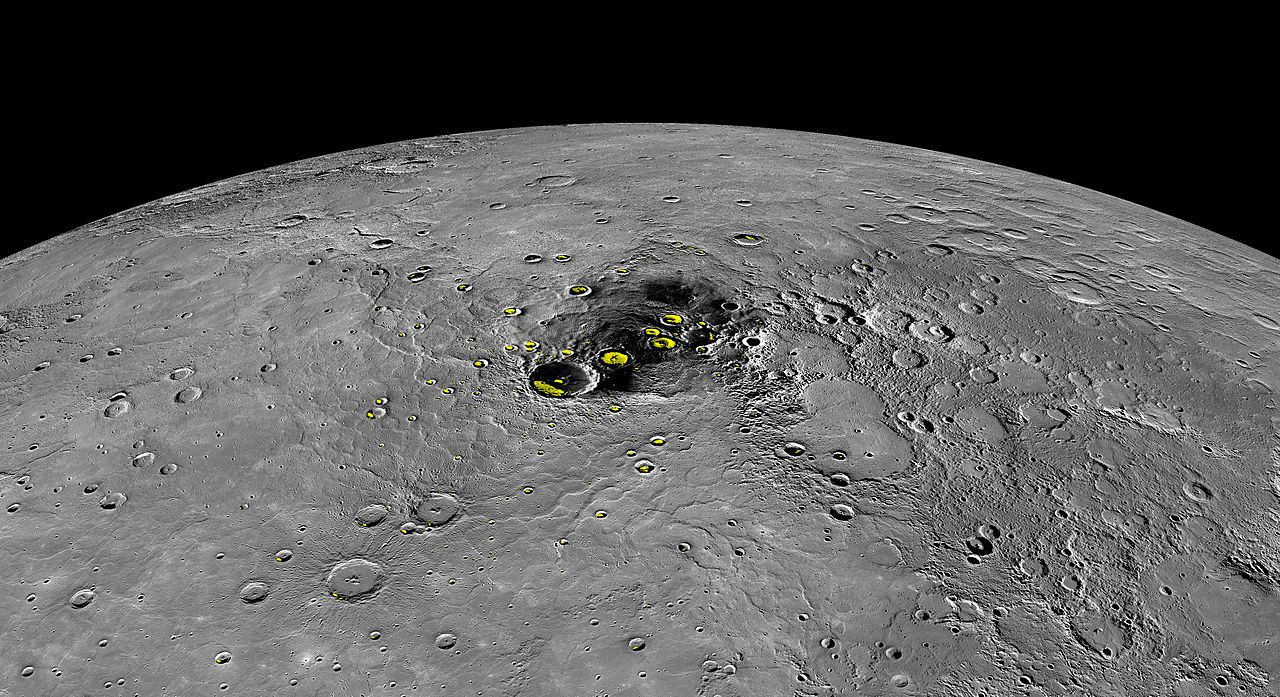
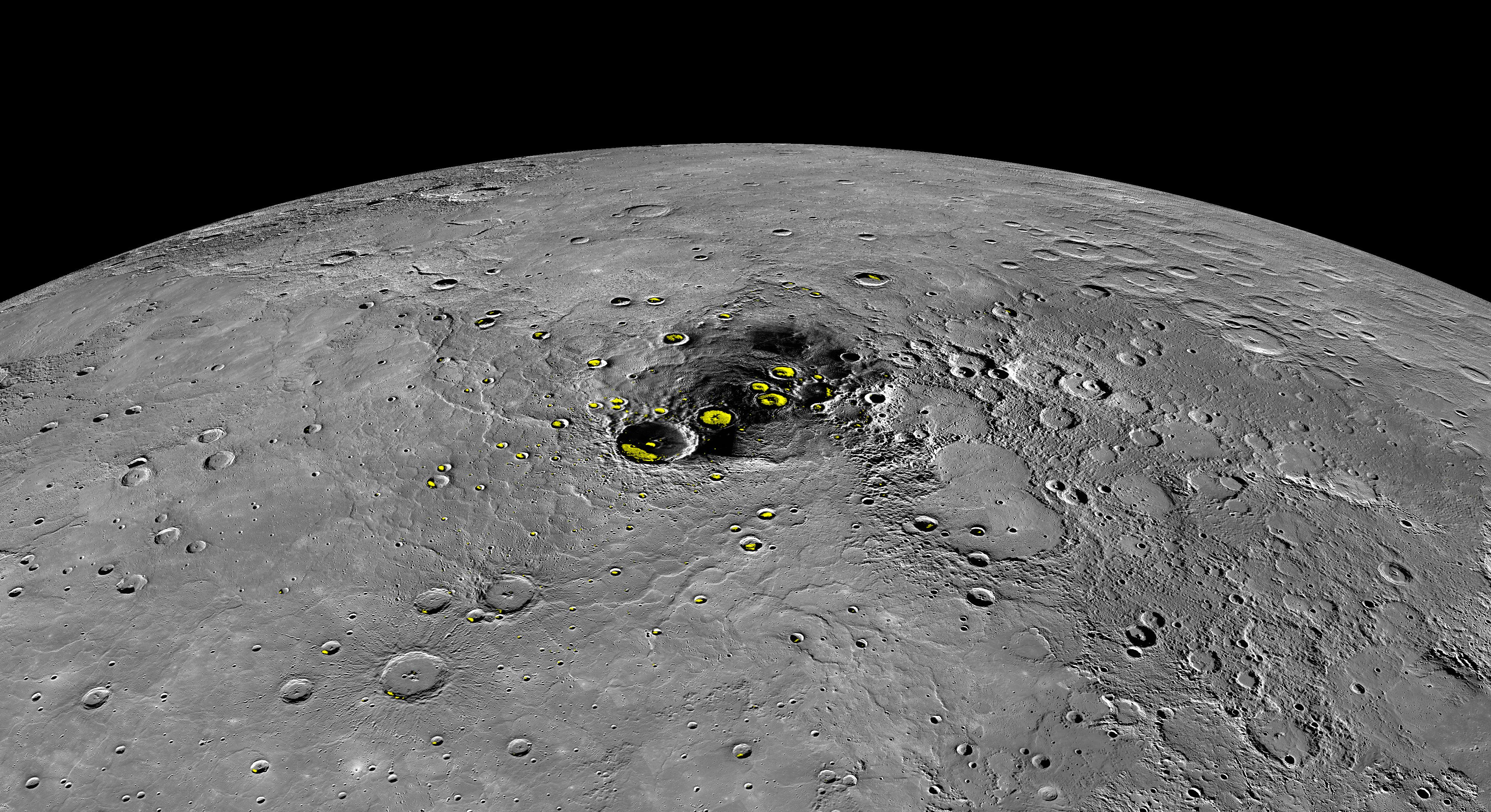
PIA19411: Water Ice on Mercury
http://photojournal.jpl.nasa.gov/catalog/PIA19411 This orthographic projection view provides a look at Mercury's north polar region. The yellow regions in many of the craters mark locations that show evidence for water ice, as detected by Earth-based radar observations from Arecibo Observatory in Puerto Rico. MESSENGER has collected compelling new evidence that the deposits are indeed water ice, including imaging within the permanently shaded interiors of some of the craters, such as Prokofiev and Fuller. Instrument: Mercury Dual Imaging System (MDIS) Arecibo Radar Image: In yellow (Harmon et al., 2011, Icarus 211, 37-50) The MESSENGER spacecraft is the first ever to orbit the planet Mercury, and the spacecraft's seven scientific instruments and radio science investigation are unraveling the history and evolution of the Solar System's innermost planet. In the mission's more than four years of orbital operations, MESSENGER has acquired over 250,000 images and extensive other data sets. MESSENGER's highly successful orbital mission is about to come to an end, as the spacecraft runs out of propellant and the force of solar gravity causes it to impact the surface of Mercury in April 2015. |
| Date | |
| Source | http://photojournal.jpl.nasa.gov/jpeg/PIA19411.jpg |
| Author | NASA/Johns Hopkins University Applied Physics Laboratory/Carnegie Institution of Washington |
Licensing
|
|
This file is in the public domain in the United States because it was solely created by NASA . NASA copyright policy states that "NASA material is not protected by copyright unless noted ". (See Template:PD-USGov , NASA copyright policy page or JPL Image Use Policy .) |
|

|
Warnings:
|