Pannonia02.png

Size of this preview:
668 × 599 pixels
.
Other resolutions:
268 × 240 pixels
|
535 × 480 pixels
|
1,001 × 898 pixels
.
Summary
| Description |
English:
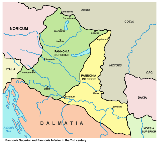
Historic map - Roman provinces Pannonia Superior and Pannonia Inferior in the 2nd century.
Српски / srpski:
Istorijska karta - Rimske provincije Gornja Panonija i Donja Panonija u 2. veku.
|
||
| Date | |||
| Source |
|
||
| Author | PANONIAN ( talk · contribs ) |

Licensing
|
|
I, the copyright holder of this work, release this work into the
public domain
. This applies worldwide.
In some countries this may not be legally possible; if so: I grant anyone the right to use this work for any purpose , without any conditions, unless such conditions are required by law. |