Partition_of_Babylon_323_BC.png
Size of this preview:
800 × 434 pixels
.
Other resolutions:
320 × 174 pixels
|
640 × 347 pixels
|
1,024 × 556 pixels
|
1,280 × 695 pixels
|
2,560 × 1,390 pixels
|
4,093 × 2,222 pixels
.
Summary
| Description |
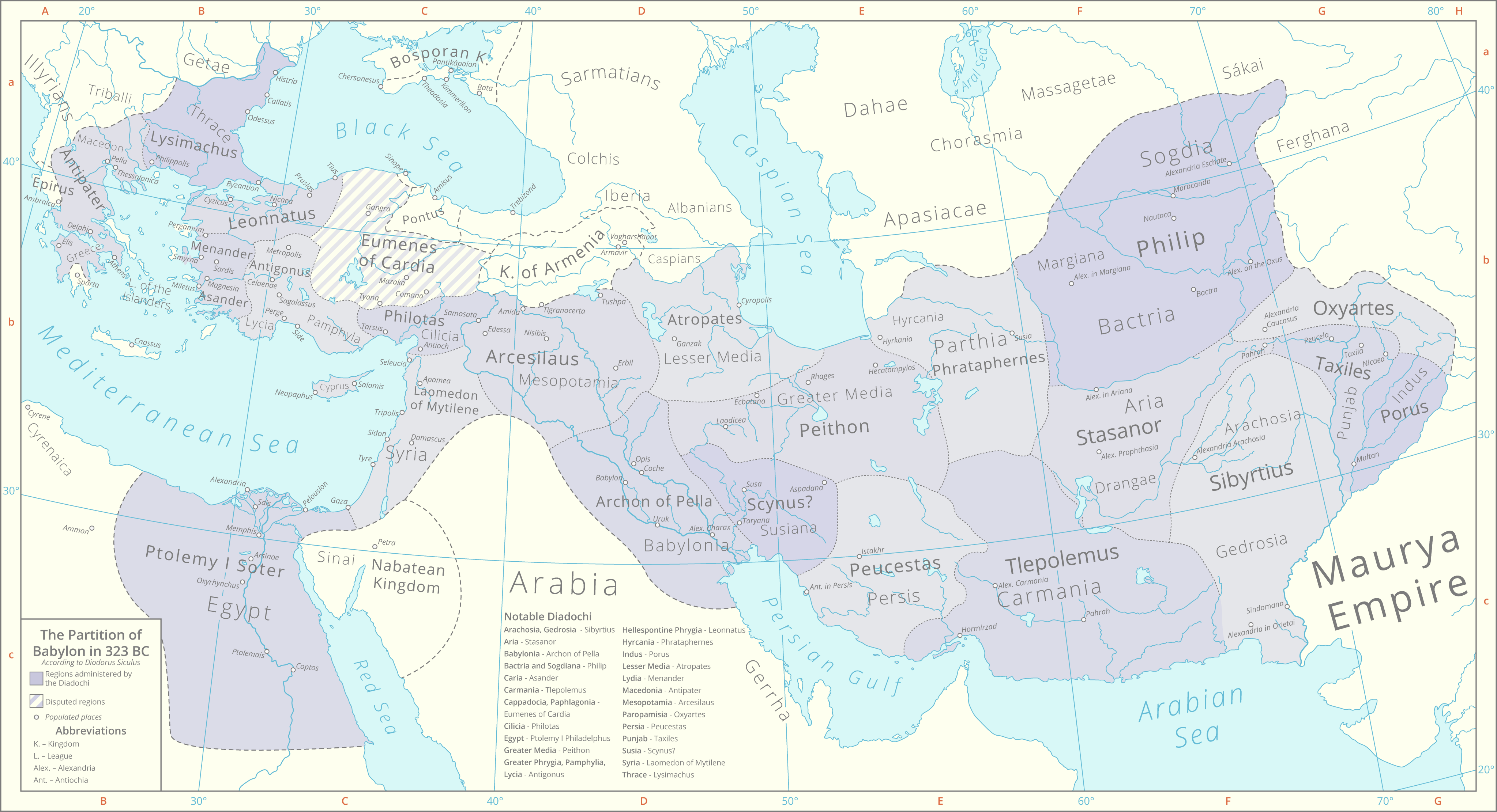
English:
This map details the division of
Alexander's
Empire as per the
Partition of Babylon
in 323 BC according to the historian
Diodorus Siculus
.
Historical lakes and coastlines are derived from the Ancient World Mapping Center [1] . The boundaries of the peripheral kingdoms are based on these maps File:Bosporan Kingdom growth map-en.svg File:Hellenistic world and Maurya Empire 281 BCE.png |
| Date | |
| Source | Own work |
| Author | Cattette |
Licensing
I, the copyright holder of this work, hereby publish it under the following license:
This file is licensed under the
Creative Commons
Attribution 4.0 International
license.
-
You are free:
- to share – to copy, distribute and transmit the work
- to remix – to adapt the work
-
Under the following conditions:
- attribution – You must give appropriate credit, provide a link to the license, and indicate if changes were made. You may do so in any reasonable manner, but not in any way that suggests the licensor endorses you or your use.