Passchendaele_aerial_view.jpg
Size of this preview:
445 × 600 pixels
.
Other resolutions:
178 × 240 pixels
|
500 × 674 pixels
.
|

|
This image has been assessed under the valued image criteria and is considered the most valued image on Commons within the scope: the Battle of Passchendaele . You can see its nomination here . |
| Description |
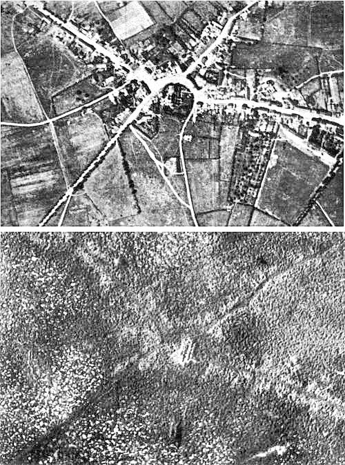
English:
Aerial view of the village of
Passchendaele
(north is to the right of the photo) before and after the
Third Battle of Ypres
, 1917.
Français :
Vue aerienne du village de
Passendale
, avant et après la
troisième bataille d'Ypres
, en 1917. Le nord est à droite sur les photos.
|
|||
| Date | ||||
| Source |
|
|||
| Author | Photographer not identified. "Official photograph". | |||
|
Permission
( Reusing this file ) |
|
|||
| Other versions |
|


| Camera location |
|
View this and other nearby images on: OpenStreetMap |
|
|---|