Persian(IRAN)_Empire_1747.jpg
Size of this preview:
715 × 600 pixels
.
Other resolutions:
286 × 240 pixels
|
572 × 480 pixels
|
915 × 768 pixels
|
1,220 × 1,024 pixels
|
2,441 × 2,048 pixels
|
5,420 × 4,548 pixels
.
Summary
| Description |
English:
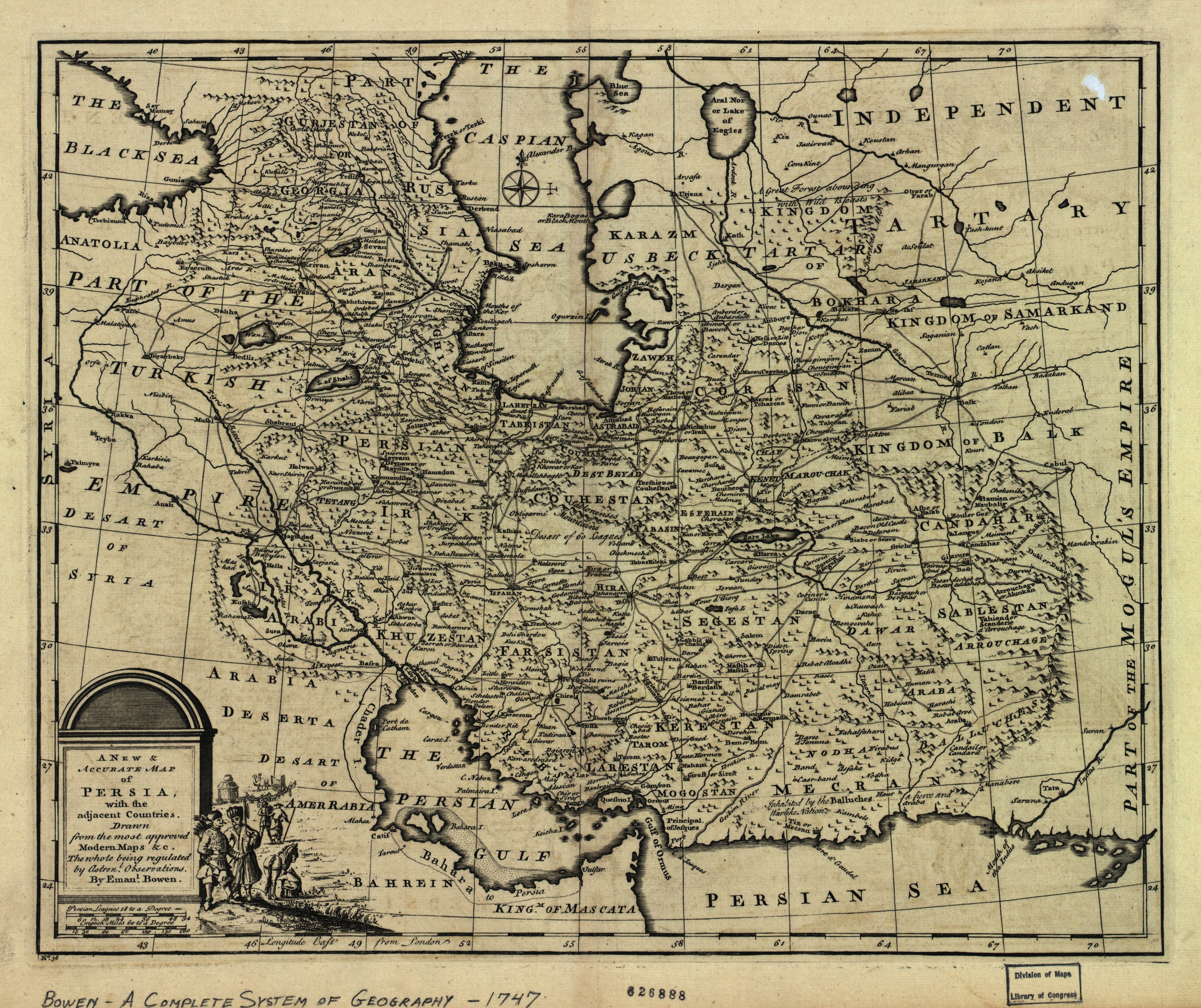
The map of the Persian Empire in 1747 at the time of Afsharid Dynasty. a complete system of geography.
فارسی:
نقشهٔ امپراطوری ایران در سال ۱۷۴۷ میلادی برابر با ۱۱۲۶ خورشیدی و ۱۱۶۰ قمری در زمان دودمان افشاریان
|
|||||||||||||||||||||||
| Date | circa 1750 | |||||||||||||||||||||||
| Source | http://memory.loc.gov/ | |||||||||||||||||||||||
| Author |
|
|||||||||||||||||||||||
| Other versions |
Derivative works of this file: |
|||||||||||||||||||||||

_Empire_1747_(A).JPG)
_Empire_1747_(B).JPG)
|
_Empire_1747.jpg)
Licensing
|
This is a faithful photographic reproduction of a two-dimensional,
public domain
work of art. The work of art itself is in the public domain for the following reason:
The official position taken by the Wikimedia Foundation is that "
faithful reproductions of two-dimensional public domain works of art are public domain
".
This photographic reproduction is therefore also considered to be in the public domain in the United States. In other jurisdictions, re-use of this content may be restricted; see Reuse of PD-Art photographs for details. |
||||