Piccadilly_Station_Manchester_-_geograph.org.uk_-_692981.jpg
No higher resolution available.
Summary
| Description |
English:
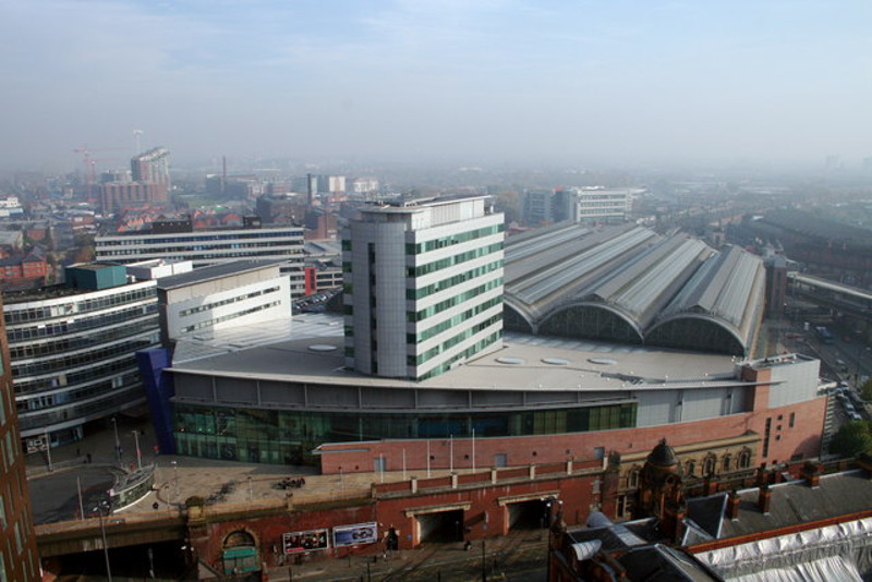
Piccadilly Station Manchester Store Street Station opened in 1842 as the terminus of the Manchester and Birmingham Railway. As the rail network expanded it became London Road Station in 1849. It was rebuilt and became Manchester Piccadilly in 1960 for the new London Midland Region electric service to London. The two openings visible at the bottom centre of the photograph are for the Manchester Metrolink trams which went into service in 1992. The station was extensively modified for the 2002 Commonwealth Games.
|
| Date | |
| Source | From geograph.org.uk |
| Author | Peter Hyde |
|
Attribution
( required by the license ) |
Peter Hyde / Piccadilly Station Manchester / |
| Camera location |
|
View this and other nearby images on: OpenStreetMap |
|
|---|
_heading:90.00&language=en)
| Object location |
|
View this and other nearby images on: OpenStreetMap |
|
|---|
_heading:90.00&language=en)
Licensing

|
This image was taken from the
Geograph project
collection. See
this photograph's page
on the Geograph website for the photographer's contact details. The copyright on this image is owned by
Peter Hyde
and is licensed for reuse under the
Creative Commons
Attribution-ShareAlike 2.0 license.
|
This file is licensed under the
Creative Commons
Attribution-Share Alike 2.0 Generic
license.
Attribution:
Peter Hyde
-
You are free:
- to share – to copy, distribute and transmit the work
- to remix – to adapt the work
-
Under the following conditions:
- attribution – You must give appropriate credit, provide a link to the license, and indicate if changes were made. You may do so in any reasonable manner, but not in any way that suggests the licensor endorses you or your use.
- share alike – If you remix, transform, or build upon the material, you must distribute your contributions under the same or compatible license as the original.