Pinckney's_Treaty_line_1795.png
Size of this preview:
711 × 599 pixels
.
Other resolutions:
285 × 240 pixels
|
570 × 480 pixels
|
911 × 768 pixels
|
1,164 × 981 pixels
.
Summary
| Description |
English:
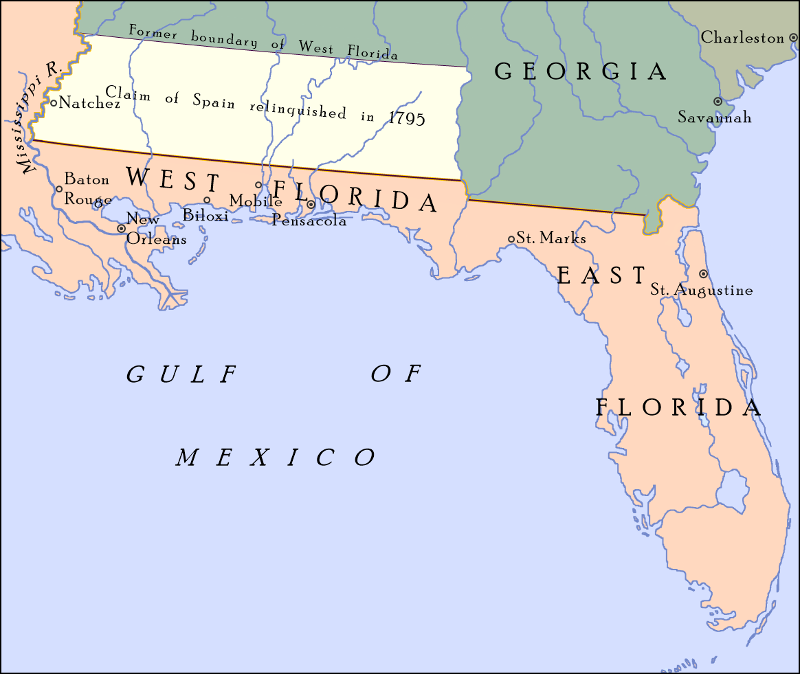
Map showing the boundary between the United States and Spanish Florida as set by "Pinckney's Treaty"—signed on October 27, 1795 and became effective on August 3, 1796—at 31°N; also shown is the portion of Spanish West Florida between 31°N and 32° 22′, which Spain relinquished its claim to in the treaty. On April 7, 1798, Congress organized the region as the Mississippi Territory.
[1]
|
| Date | |
| Source |
Own work ; map detail from The United States, 1783–1803 , Perry-Castañeda Library Map Collection: Historical Maps of the United States, Perry-Castañeda Library, The University of Texas at Austin |
| Author | Drdpw |
Licensing
I, the copyright holder of this work, hereby publish it under the following license:
This file is licensed under the
Creative Commons
Attribution-Share Alike 4.0 International
license.
-
You are free:
- to share – to copy, distribute and transmit the work
- to remix – to adapt the work
-
Under the following conditions:
- attribution – You must give appropriate credit, provide a link to the license, and indicate if changes were made. You may do so in any reasonable manner, but not in any way that suggests the licensor endorses you or your use.
- share alike – If you remix, transform, or build upon the material, you must distribute your contributions under the same or compatible license as the original.
- ↑ Pinckney's Treaty Encyclopedia Britannica