Planisphæri_cœleste.jpg
Size of this preview:
800 × 547 pixels
.
Other resolutions:
320 × 219 pixels
|
640 × 437 pixels
|
1,024 × 700 pixels
|
1,280 × 875 pixels
|
2,560 × 1,750 pixels
|
5,812 × 3,972 pixels
.
Summary
| Author |
|
|||||||||||||||||||||||||
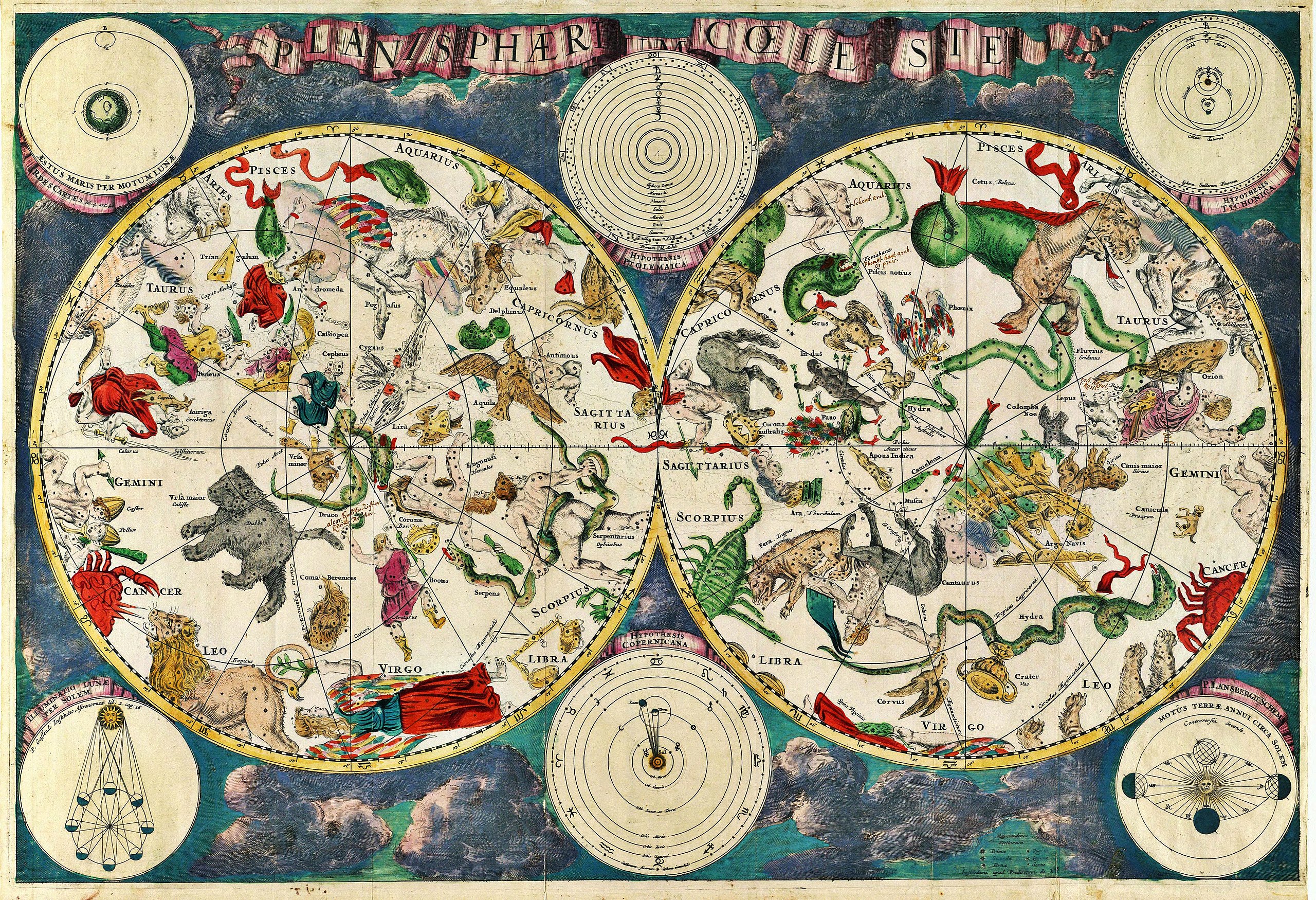
| Description |
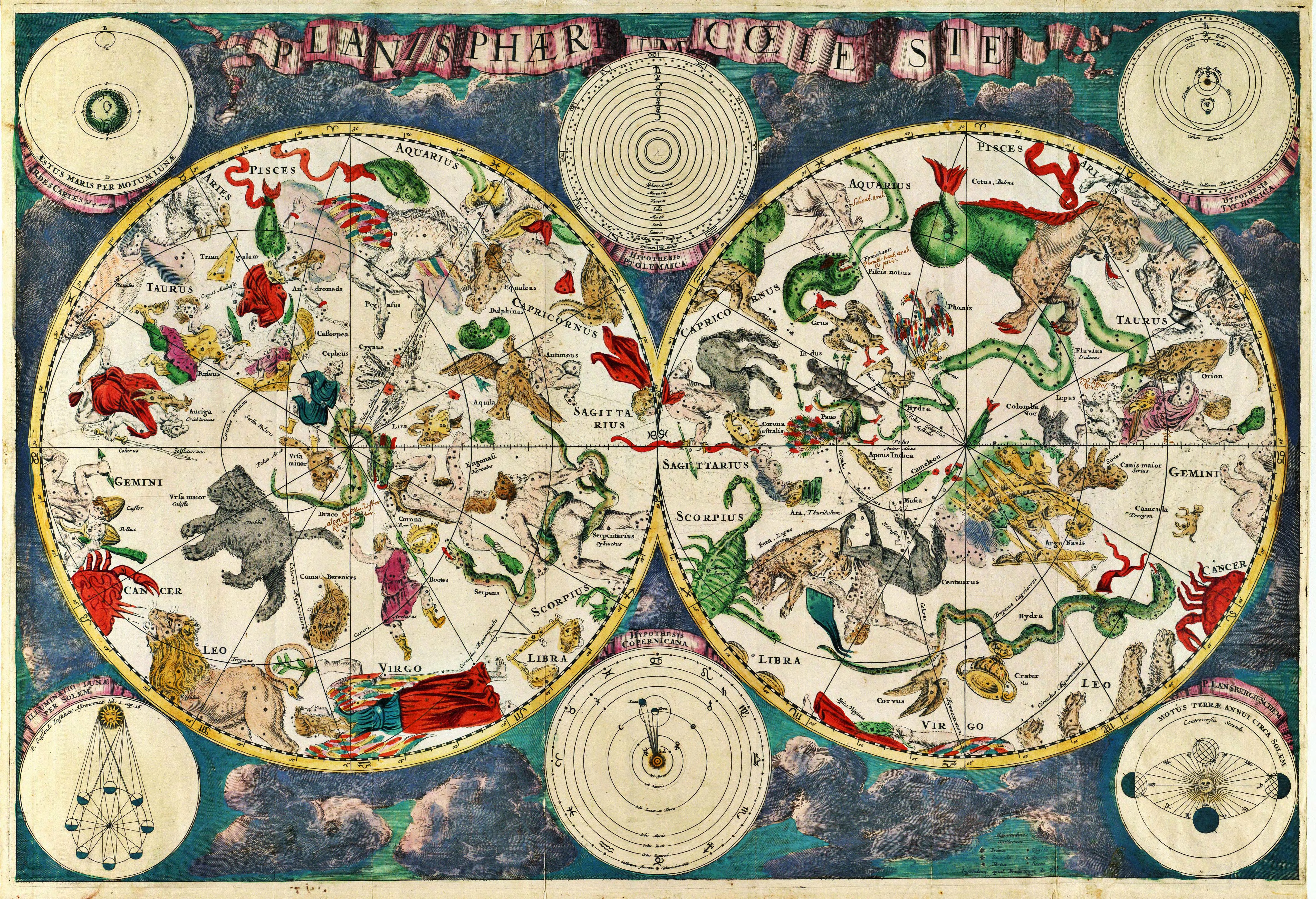
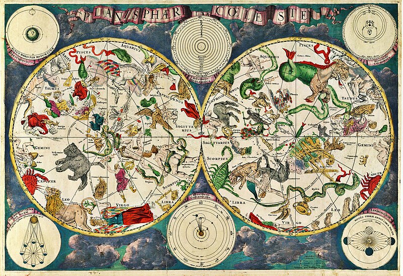
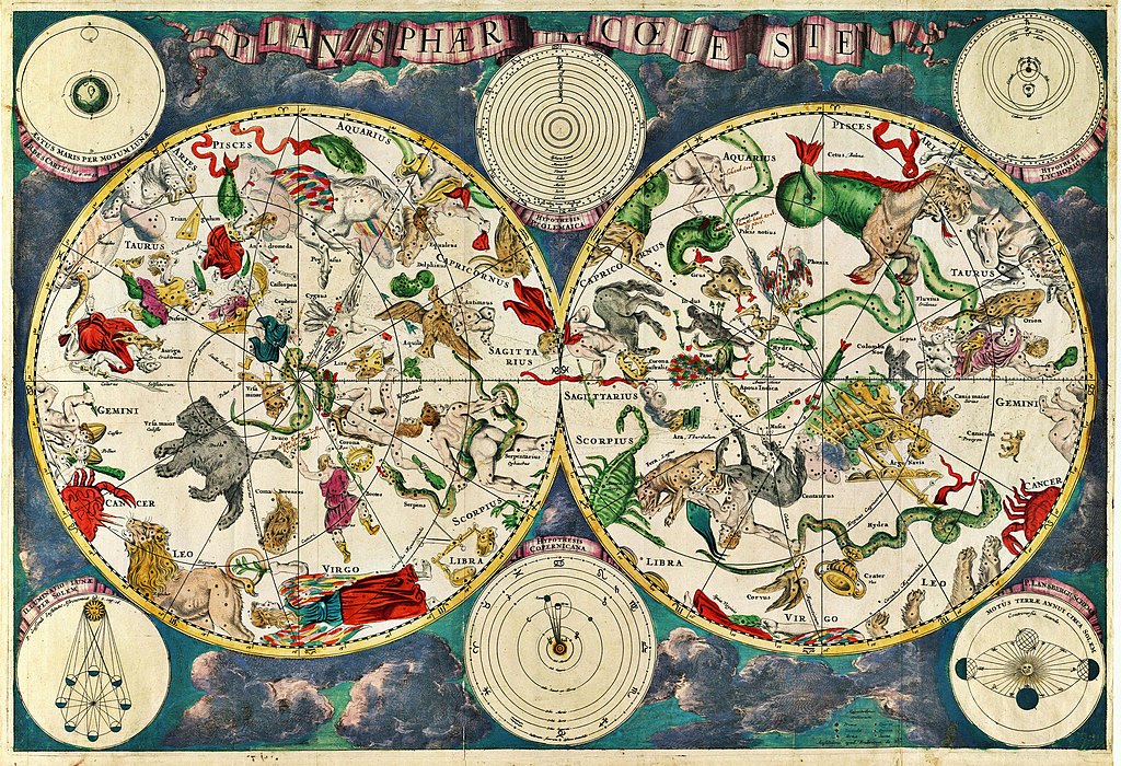
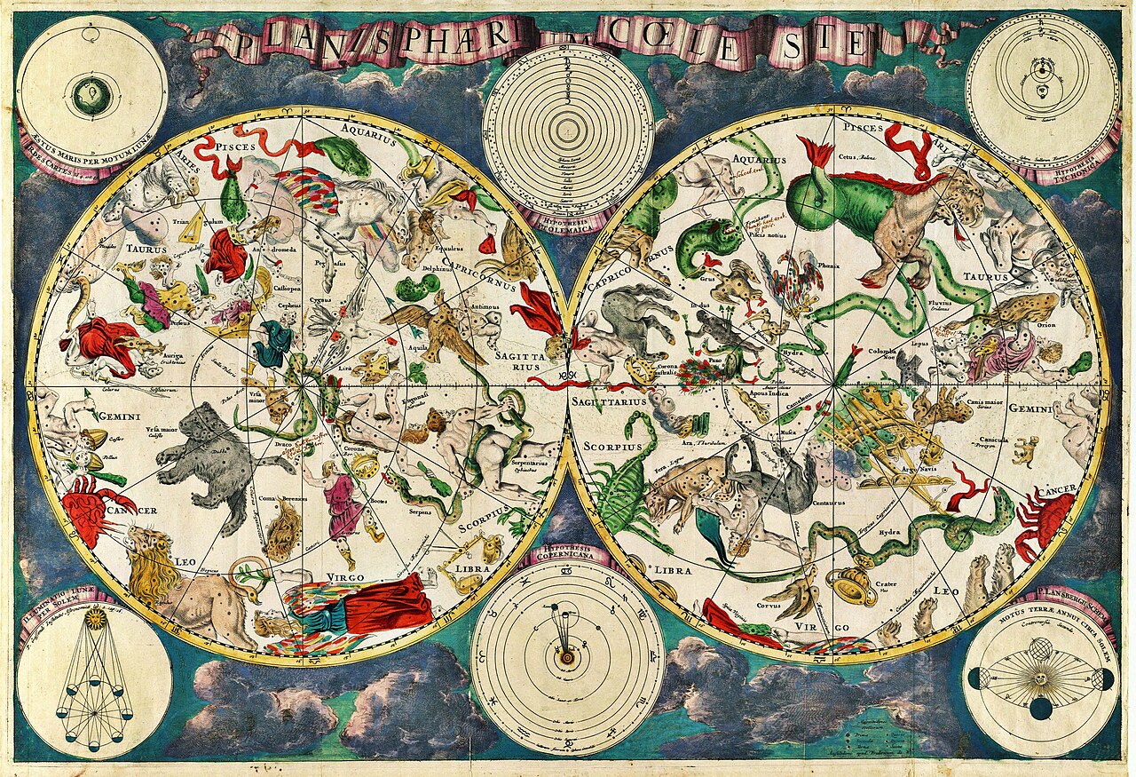
Planisphærium cœleste, denmark, Frederik V
English:
Celestial map
Français :
Carte céleste
|
|||||||||||||||||||||||||
| Date | 1670 | |||||||||||||||||||||||||
| References | Koninklijke Deense Bibliotheek | |||||||||||||||||||||||||
| Source/Photographer | Transferred from en.wikipedia to Commons. Scanned by Janke | |||||||||||||||||||||||||
Original upload log
The original description page was
here
. All following user names refer to en.wikipedia.
- 2007-03-10 18:20 Janke 1804×1236×8 (3237455 bytes) Celestial map from the 17th century, by the Dutch cartographer Frederik de Wit. Scanned by uploader
Licensing
|
This is a faithful photographic reproduction of a two-dimensional,
public domain
work of art. The work of art itself is in the public domain for the following reason:
The official position taken by the Wikimedia Foundation is that "
faithful reproductions of two-dimensional public domain works of art are public domain
".
This photographic reproduction is therefore also considered to be in the public domain in the United States. In other jurisdictions, re-use of this content may be restricted; see Reuse of PD-Art photographs for details. |
||||