Plate_tectonics_map.gif
Size of this preview:
800 × 541 pixels
.
Other resolutions:
320 × 216 pixels
|
640 × 433 pixels
|
1,024 × 692 pixels
|
1,280 × 865 pixels
|
2,560 × 1,731 pixels
|
3,380 × 2,285 pixels
.
Summary
| Description |
English:
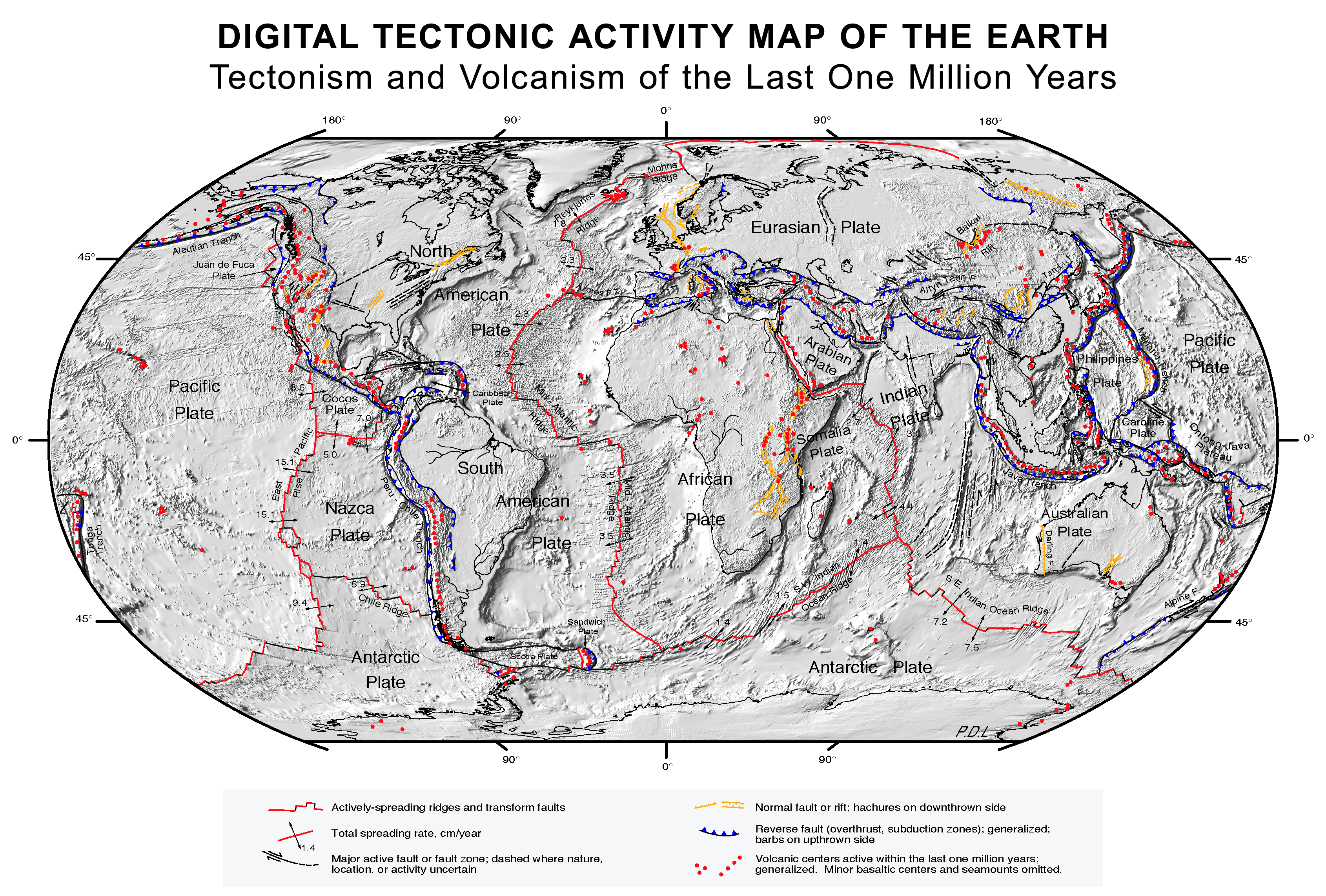
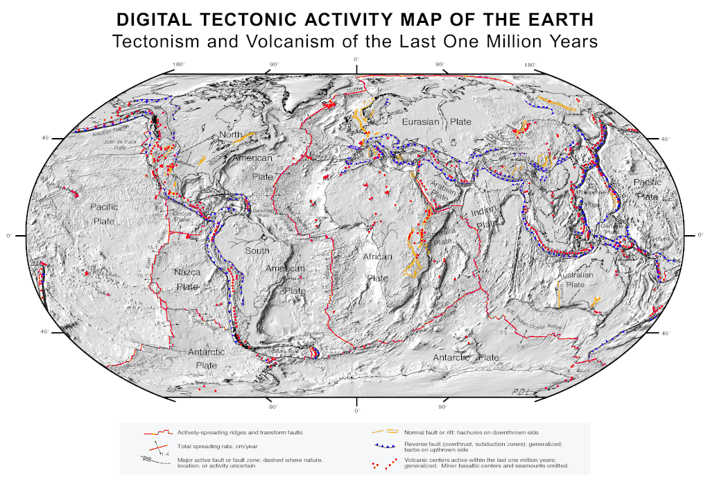
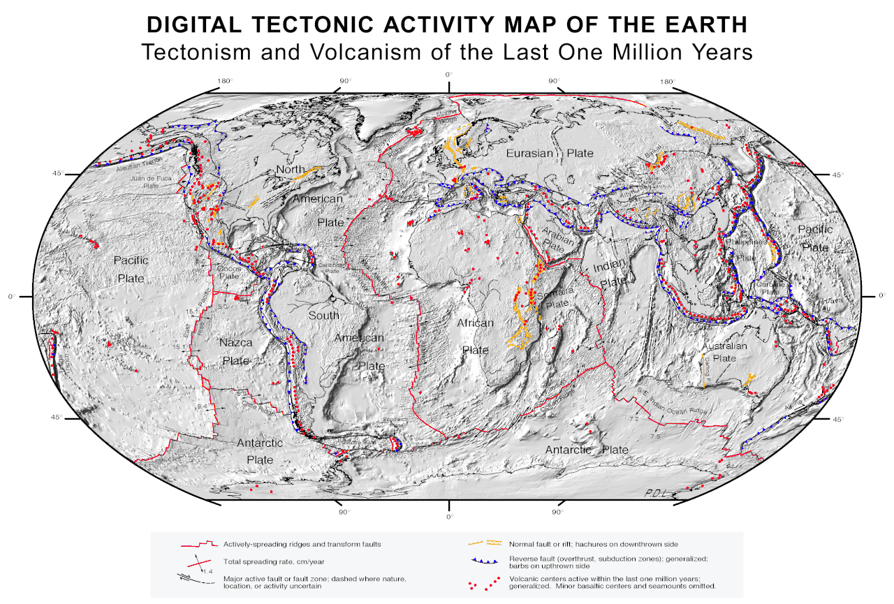
Quake epicenters
Digital Tectonic Activity Map of the Earth (DTAM):
|
| Date | October 2002 |
| Source |
|
| Creator |
NASA/Goddard Space Flight Center
|
| Geotemporal data | |
| Spatial reference system | Robinson Projection |
| Georeferencing | If inappropriate please set warp_status = skip to hide. |
Licensing
|
|
This file is in the public domain in the United States because it was solely created by NASA . NASA copyright policy states that "NASA material is not protected by copyright unless noted ". (See Template:PD-USGov , NASA copyright policy page or JPL Image Use Policy .) |
|

|
Warnings:
|