Plymouth_siege_map_1643.gif

Summary
| Description |
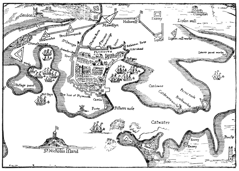
English:
Part of "A True Mapp and Description of the Towne of Plymouth and the Fortifications thereof at the last siege, A. 1643"
|
| Date | 17th century, after 1643. |
| Source | A 17th century map, reproduced in Bracken: A History of Plymouth, 1931, opp. p126. |
| Author | Original author unknown, fl 17th century. Scanned by me 2008-07-05. |
Licensing
|
|
This work is in the public domain in its country of origin and other countries and areas where the copyright term is the author's life plus 70 years or fewer .
|
| This file has been identified as being free of known restrictions under copyright law, including all related and neighboring rights. | |