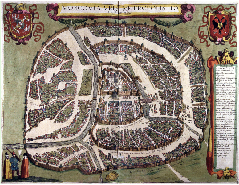
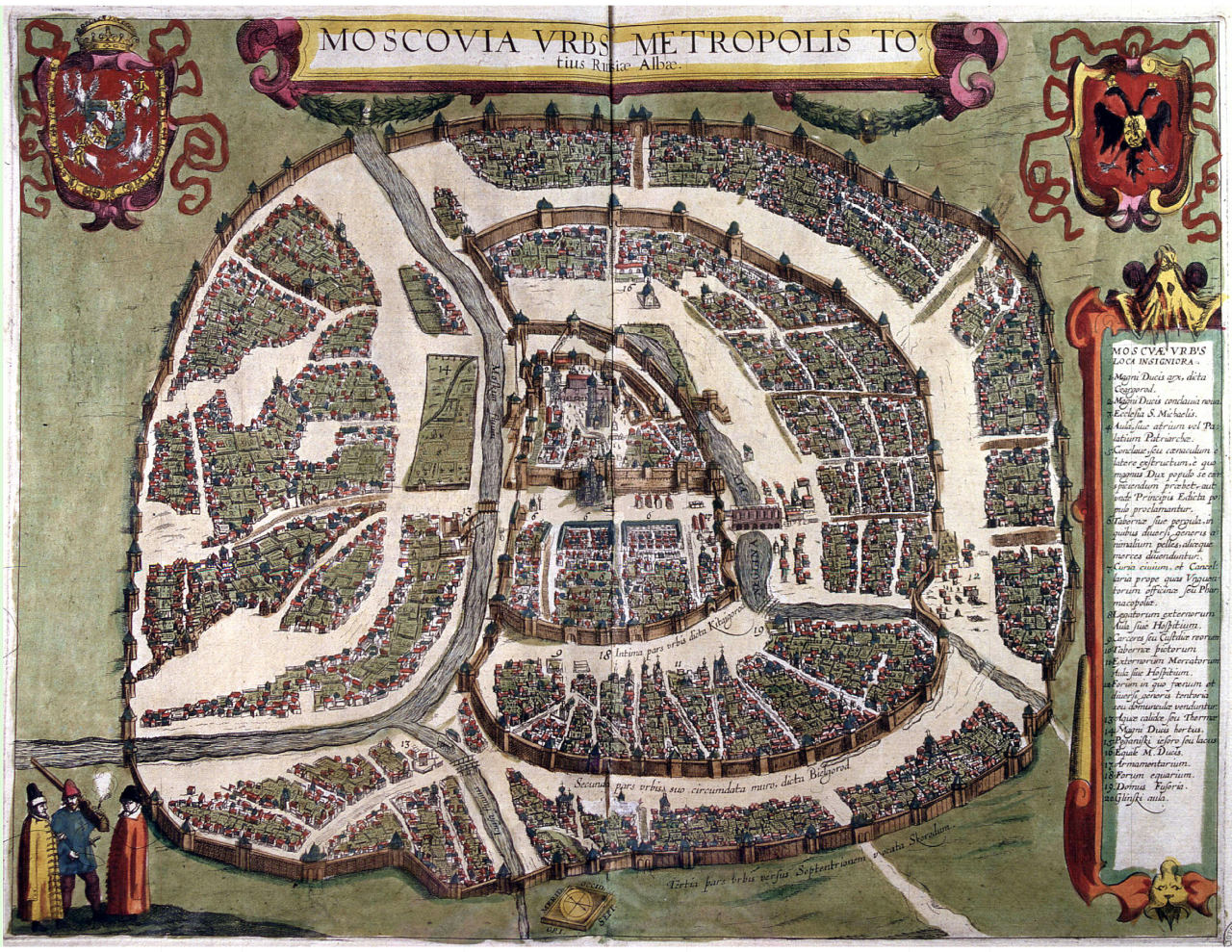
Polish_plan_of_Moscow_1610.PNG

Size of this preview:
776 × 600 pixels
.
Other resolutions:
311 × 240 pixels
|
621 × 480 pixels
|
994 × 768 pixels
|
1,280 × 989 pixels
|
2,560 × 1,978 pixels
|
6,600 × 5,100 pixels
.
Summary
| Description |
English:
Sigizmundian Plan
of
Moscow
, engraved in 1610, is the last city plan compiled (by the Poles) before the destruction of the city in 1612 and subsequent changes to the street network. Orientation: North is at the right, West at the top.
Русский:
Сигизмундов чертёж
Москвы, выполненный поляками, гравированный в 1610 году. Последний по времени план Москвы, составленный до разрушений 1612 года. План развёрнут на 90 градусов: север - справа, сверху - запад.
|
| Date | |
| Source | web |
| Author | anonymous plate |
| Other versions |
|

Licensing
|
This is a faithful photographic reproduction of a two-dimensional,
public domain
work of art. The work of art itself is in the public domain for the following reason:
The official position taken by the Wikimedia Foundation is that "
faithful reproductions of two-dimensional public domain works of art are public domain
".
This photographic reproduction is therefore also considered to be in the public domain in the United States. In other jurisdictions, re-use of this content may be restricted; see Reuse of PD-Art photographs for details. |
||||