Political_map_of_England_1153.PNG

Size of this preview:
509 × 599 pixels
.
Other resolutions:
204 × 240 pixels
|
408 × 480 pixels
|
652 × 768 pixels
|
870 × 1,024 pixels
|
1,489 × 1,753 pixels
.

|
File:Political map of England 1153.svg
is a vector version of this file. It should be used in place of this PNG file when not inferior.
File:Political map of England 1153.PNG →
File:Political map of England 1153.svg
For more information, see
Help:SVG
.
|

|
Summary
| Description |
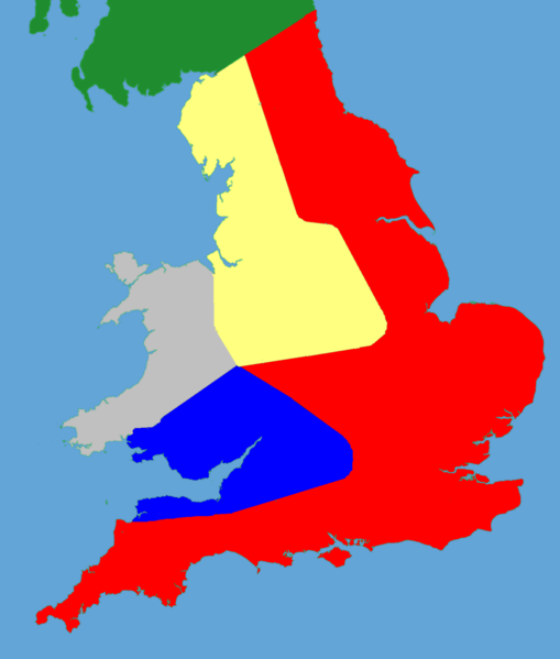
English:
A political map of southern Britain in 1153
|
| Date | (UTC) |
| Source |
Own work using:
|
| Author |
|
|
|
This is a
retouched picture
, which means that it has been digitally altered from its original version. Modifications:
Trimmed and historical details added
. The original can be viewed here:
Gb4dot.svg
:
|
I, the copyright holder of this work, hereby publish it under the following license:
|
|
I, the copyright holder of this work, release this work into the
public domain
. This applies worldwide.
In some countries this may not be legally possible; if so: I grant anyone the right to use this work for any purpose , without any conditions, unless such conditions are required by law. |
Original upload log
This image is a derivative work of the following images:
- File:Gb4dot.svg licensed with PD-self
Uploaded with derivativeFX