Prussian_Settlement_Commission.JPG
No higher resolution available.
Summary
| Description |
English:
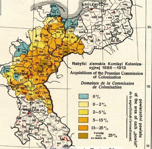
The Prussian Partition of Poland. Acquisitions of the Prussian Commission of Colonization 1886-1913.
Polski:
Zabór pruski. Nabytki ziemskie Komisji Kolonizacyjnej w latach 1886-1913.
Deutsch:
Die Königlich Preußische Ansiedlungskommission für Westpreußen und Posen.
|
||||||
| Date | |||||||
| Source | Transferred from en.wikipedia to Commons by Artur Andrzej . | ||||||
| Author | Romer's atlas Geograficzno-Statystyczny Atlas Polski by Dr. Eugenjusz Romer, published in 1916 and in 1921. | ||||||
|
Permission
( Reusing this file ) |
|


Original upload log
The original description page was
here
. All following user names refer to en.wikipedia.
- 2008-09-14 21:30 Molobo 493×484 (90 KB)