Pueblos_originarios_de_Bolivia.png

Size of this preview:
532 × 600 pixels
.
Other resolutions:
213 × 240 pixels
|
426 × 480 pixels
|
681 × 768 pixels
|
908 × 1,024 pixels
|
2,370 × 2,672 pixels
.
Summary
| Description |
English:
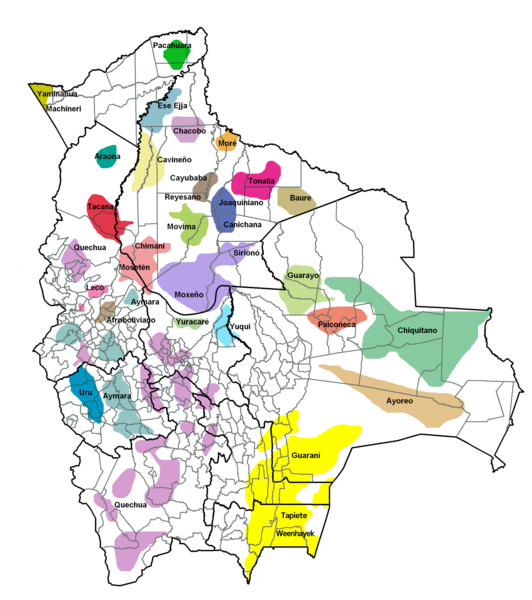
Map of the locations of the indigenous settlements of Bolivia.
Español:
Mapa de ubicación de los Pueblos Originarios de Bolivia.
|
||||||||
| Date | |||||||||
| Source | Own work | ||||||||
| Author | Rojk | ||||||||
|
Permission
( Reusing this file ) |
Rojk
, the copyright holder of this work, hereby publishes it under the following licenses:
This file is licensed under the
Creative Commons
Attribution-Share Alike
2.5 Generic
,
2.0 Generic
and
1.0 Generic
license.
Attribution:
Rojk
You may select the license of your choice.
|


|
This
linguistic map
image could be re-created
using
vector graphics
as an
SVG
file
. This has several advantages; see
Commons:Media for cleanup
for more information. If an SVG form of this image is available, please upload it and afterwards replace this template with
{{

vector version available

|

new image name

}}
.
It is recommended to name the SVG file “Pueblos originarios de Bolivia.svg”—then the template Vector version available (or Vva ) does not need the new image name parameter. |