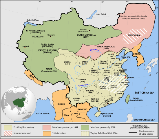
Qing_Empire_circa_1820_EN.svg

Size of this PNG preview of this SVG file:
686 × 600 pixels
.
Other resolutions:
275 × 240 pixels
|
549 × 480 pixels
|
879 × 768 pixels
|
1,172 × 1,024 pixels
|
2,343 × 2,048 pixels
|
849 × 742 pixels
.

|
This file requires updating because:
The island of Sumatra as depicted on the small globe in the lower left is colliding with Atlantis (Tuva?) and a peninsula unknown to modern geography is extending off the western coast of India. The eastern coast of Taiwan was never under the sovereignty of the Qing Empire.
In doing so, you could add a timestamp to the file.
|
Summary
| Description |
English:
Qing Empire
c. 1820
|
| Date | |
| Source | Own work Incorporates modified version of File:Empire of the Great Qing (orthographic projection).svg . Note that the map excludes Tawang from Tibet. |
| Author | Philg88 : Attribution Wikimedia Foundation, www.wikimedia.org |
.svg)
Licensing
This file is licensed under the
Creative Commons
Attribution 4.0 International
license.
-
You are free:
- to share – to copy, distribute and transmit the work
- to remix – to adapt the work
-
Under the following conditions:
- attribution – You must give appropriate credit, provide a link to the license, and indicate if changes were made. You may do so in any reasonable manner, but not in any way that suggests the licensor endorses you or your use.