Rakahanga.jpg
Size of this preview:
509 × 600 pixels
.
Other resolutions:
204 × 240 pixels
|
634 × 747 pixels
.
Summary
| Description |
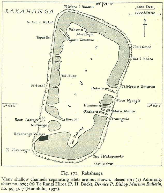
English:
Map of Rakahanga Atoll, Northern Cook Islands
|
| Date | |
| Source | http://www.lib.utexas.edu/maps/historical/pacific_islands_1943_1945/rakahanga.jpg |
| Author | US Army |
Licensing
|
|
This file is in the
public domain
because
it has been taken from a collection of public domain maps at the University of Texas Library
|