Roanoke_map_1584.JPG
Size of this preview:
293 × 598 pixels
.
Other resolutions:
117 × 240 pixels
|
235 × 480 pixels
|
648 × 1,323 pixels
.
Summary
| Description |
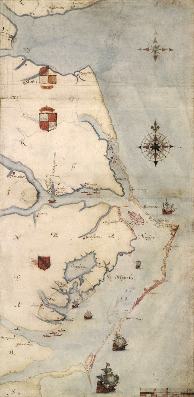
1585 map of the east coast of North America from the Chesapeake Bay to Cape Lookout by John White.
Nederlands:
Een kaart van het Roanoke-gebied, door John White
|
|||||||||||||||||||||||
| Date | between 1585 and 1593 | |||||||||||||||||||||||
| Source | A British Museum photograph of the map. [1] | |||||||||||||||||||||||
| Author |
|
|||||||||||||||||||||||

|
|
This is a
retouched picture
, which means that it has been digitally altered from its original version. Modifications:
cropped and slight levels adjustment
. Modifications made by
Earthsound
.
|
Licensing
|
This is a faithful photographic reproduction of a two-dimensional,
public domain
work of art. The work of art itself is in the public domain for the following reason:
The official position taken by the Wikimedia Foundation is that "
faithful reproductions of two-dimensional public domain works of art are public domain
".
This photographic reproduction is therefore also considered to be in the public domain in the United States. In other jurisdictions, re-use of this content may be restricted; see Reuse of PD-Art photographs for details. |
||||