Rock_of_Cashel,_Tipperary.jpg
Size of this preview:
800 × 514 pixels
.
Other resolutions:
320 × 206 pixels
|
640 × 411 pixels
|
1,024 × 658 pixels
.
| Description |
English:
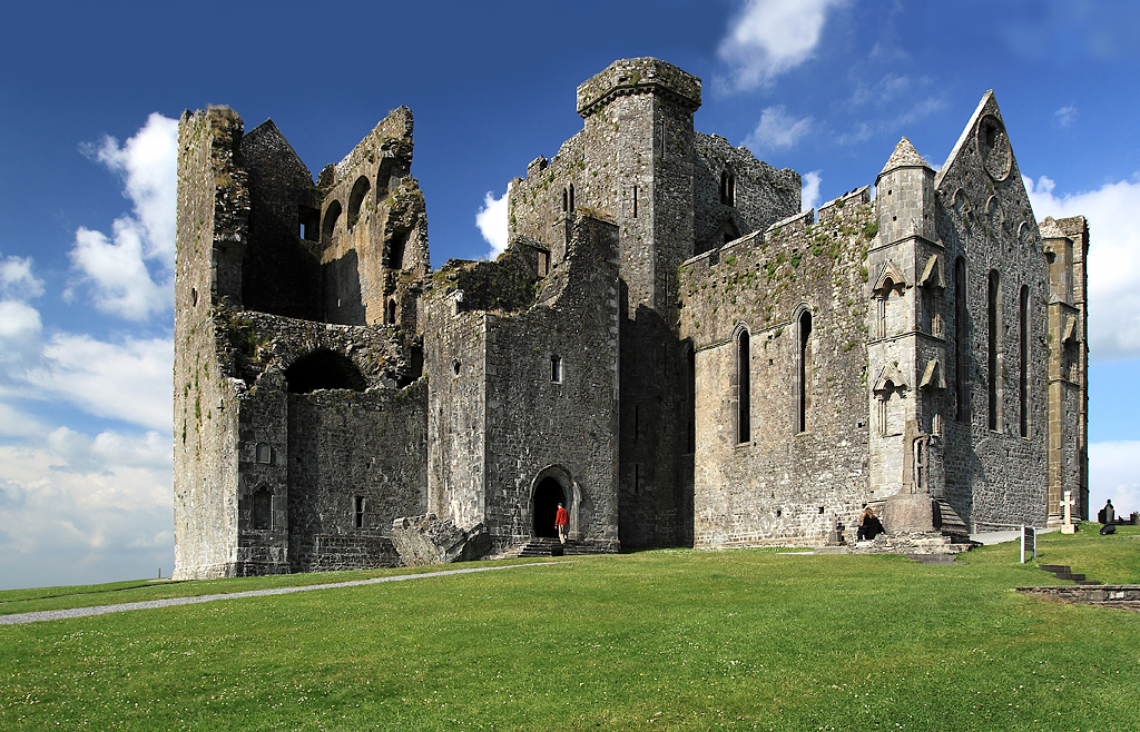
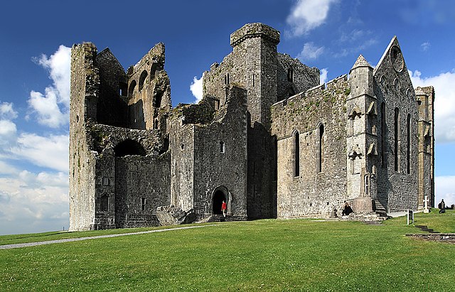
Rock of Cashel, Tipperary, Munster, Ireland.
The view is of the cathedral and its attached castle on the Rock of Cashel. From the earliest of times, and before these buildings were erected, what is now the cathedral close was always a fortress. It was then the seat of Brian Boru, crowned High King of Ireland in 977, but in 1101 it was handed over to the church by Muircheartach O'Brien. Violence erupted on the Rock in 1647 when the Rock of Cashel was stormed by Lord Inchiquin's forces. During the conflict twenty clerics who had taken refuge there were killed within the castle, as were all the Irish Confederate troops.
|
| Date | |
| Source | see below |
| Author | Mike Searle |
|
Permission
( Reusing this file ) |
Creative Commons Attribution Share-alike license 2.0 |
|
Attribution
( required by the license ) |
Mike Searle / Castles of Munster: Cashel, Rock of Cashel, Tipperary / |
| Camera location |
|
View this and other nearby images on: OpenStreetMap |
|
|---|
_&language=en)
| Object location |
|
View this and other nearby images on: OpenStreetMap |
|
|---|
_&language=en)
Licensing

|
This image was taken from the
Geograph project
collection. See
this photograph's page
on the Geograph website for the photographer's contact details. The copyright on this image is owned by
Mike Searle
and is licensed for reuse under the
Creative Commons
Attribution-ShareAlike 2.0 license.
|
This file is licensed under the
Creative Commons
Attribution-Share Alike 2.0 Generic
license.
Attribution:
Mike Searle
-
You are free:
- to share – to copy, distribute and transmit the work
- to remix – to adapt the work
-
Under the following conditions:
- attribution – You must give appropriate credit, provide a link to the license, and indicate if changes were made. You may do so in any reasonable manner, but not in any way that suggests the licensor endorses you or your use.
- share alike – If you remix, transform, or build upon the material, you must distribute your contributions under the same or compatible license as the original.