Roker_Park_August_1976.jpg
No higher resolution available.
Summary
| Description |
English:
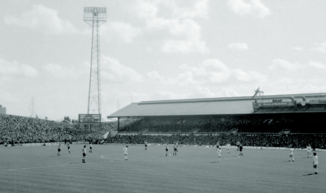
Roker Park August 1976 This is Sunderland about to kick off over 30 years ago against Arsenal. The Roker End to the left is uncovered and the stand opposite was known as the Clock Stand. If you look carefully you can see the Match of The Day cameras on top of the stand.
The ground is now gone and has a housing estate built on it now. I think there maybe a Clock Stand Drive. There is also a Goalmouth Close and of course the aptly named Promotion Close. Happy Days.
|
| Date | |
| Source | From geograph.org.uk |
| Author | John Harvey |
| Camera location |
|
View this and other nearby images on: OpenStreetMap |
|
|---|
Licensing

|
This image was taken from the
Geograph project
collection. See
this photograph's page
on the Geograph website for the photographer's contact details. The copyright on this image is owned by
John Harvey
and is licensed for reuse under the
Creative Commons
Attribution-ShareAlike 2.0 license.
|
This file is licensed under the
Creative Commons
Attribution-Share Alike 2.0 Generic
license.
Attribution:
John Harvey
-
You are free:
- to share – to copy, distribute and transmit the work
- to remix – to adapt the work
-
Under the following conditions:
- attribution – You must give appropriate credit, provide a link to the license, and indicate if changes were made. You may do so in any reasonable manner, but not in any way that suggests the licensor endorses you or your use.
- share alike – If you remix, transform, or build upon the material, you must distribute your contributions under the same or compatible license as the original.