Roman_Empire_with_provinces_in_210_AD.png

Size of this preview:
800 × 551 pixels
.
Other resolutions:
320 × 221 pixels
|
640 × 441 pixels
|
1,024 × 706 pixels
|
1,280 × 882 pixels
|
2,052 × 1,414 pixels
.
Summary
| Description |
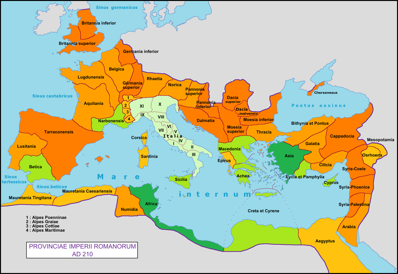
English:
Map of the Roman Empire with the provinces of 210 AD.
Français :
Carte de l'Empire romain avec ses provinces en 210 ap. J.-C.
|
| Date | |
| Source | Own work |
| Author | Mandrak |
| Other versions |
|
Licensing
|
|
I, the copyright holder of this work, release this work into the
public domain
. This applies worldwide.
In some countries this may not be legally possible; if so: I grant anyone the right to use this work for any purpose , without any conditions, unless such conditions are required by law. |