Råsunda_February_2013_01.jpg
Size of this preview:
800 × 435 pixels
.
Other resolutions:
320 × 174 pixels
|
640 × 348 pixels
|
1,024 × 556 pixels
|
1,883 × 1,023 pixels
.
Summary
| Description |
English:
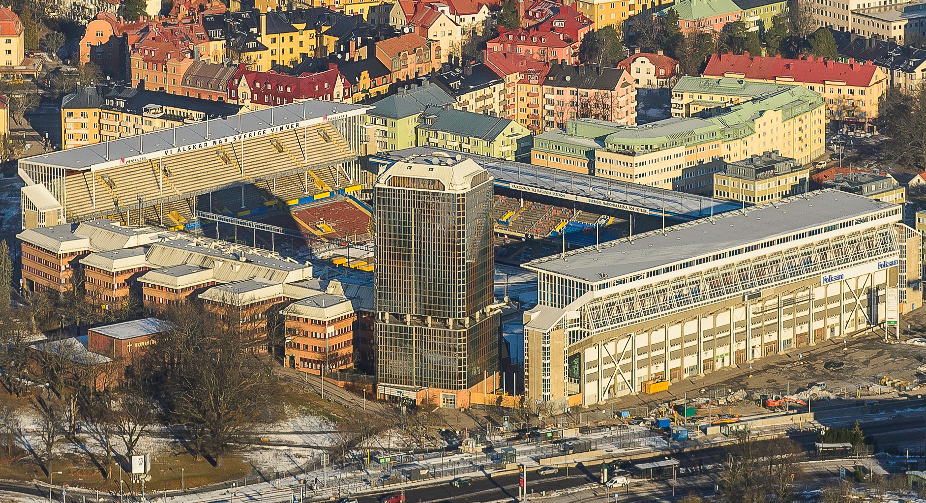
Råsunda Stadium
located in Solna Municipality in Stockholm, Sweden. Råsunda was Swedish national football stadium 1937-2012. In November 2012 it was closed down and replaced by the new Friends Arena about 1 km from Råsunda Stadium. Flats and offices will be built on the old ground.
|
| Date | |
| Source | Own work |
| Author | Arild Vågen |
| Camera location |
|
View this and other nearby images on: OpenStreetMap |
|
|---|
|
|
This aerial photograph has been approved for publishing by the Swedish Armed Forces with the ID: FMTM 10 830:10771
|
|
|
This file was made possible through the
pool of technology
at
Wikimedia Sverige
.
|
|
Licensing
I, the copyright holder of this work, hereby publish it under the following license:
This file is licensed under the
Creative Commons
Attribution-Share Alike 3.0 Unported
license.
-
You are free:
- to share – to copy, distribute and transmit the work
- to remix – to adapt the work
-
Under the following conditions:
- attribution – You must give appropriate credit, provide a link to the license, and indicate if changes were made. You may do so in any reasonable manner, but not in any way that suggests the licensor endorses you or your use.
- share alike – If you remix, transform, or build upon the material, you must distribute your contributions under the same or compatible license as the original.

|
This image has been assessed under the valued image criteria and is considered the most valued image on Commons within the scope: Råsunda Stadium (exterior) . You can see its nomination here . |