SIRACUSA_VISTA_DALLAEREO_CON_LETNA_SULLO_SFONDO.FOTO_Di_Angelo.jpg

Size of this preview:
800 × 477 pixels
.
Other resolutions:
320 × 191 pixels
|
640 × 382 pixels
|
961 × 573 pixels
.
| Camera location |
|
View this and other nearby images on: OpenStreetMap |
|
|---|
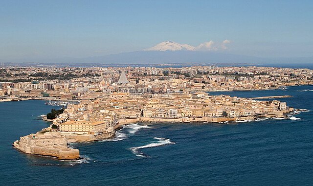
| Description | SIRACUSA VISTA DALL'AEREO CON L'ETNA SULLO SFONDO.FOTO Di Angelo; Syracuse with Mount Etna in the background | |||||
| Date | ||||||
| Source |
SIRACUSA VISTA DALL'AEREO CON L'ETNA SULLO SFONDO.FOTO Di Angelo
|
|||||
| Author | I FRATELLI ANGELO e GIORGIO BONOMO from Pomezia, ROMA, ITALIA | |||||
|
Permission
( Reusing this file ) |
|

.jpg¶ms=037.059261_N_0015.295060_E_globe:Earth_type:camera_source:Flickr_&language=en)