SaintDomingue.360.jpg
Size of this preview:
773 × 600 pixels
.
Other resolutions:
310 × 240 pixels
|
619 × 480 pixels
|
990 × 768 pixels
|
1,280 × 993 pixels
|
2,560 × 1,986 pixels
|
5,931 × 4,601 pixels
.
Summary
| Description |
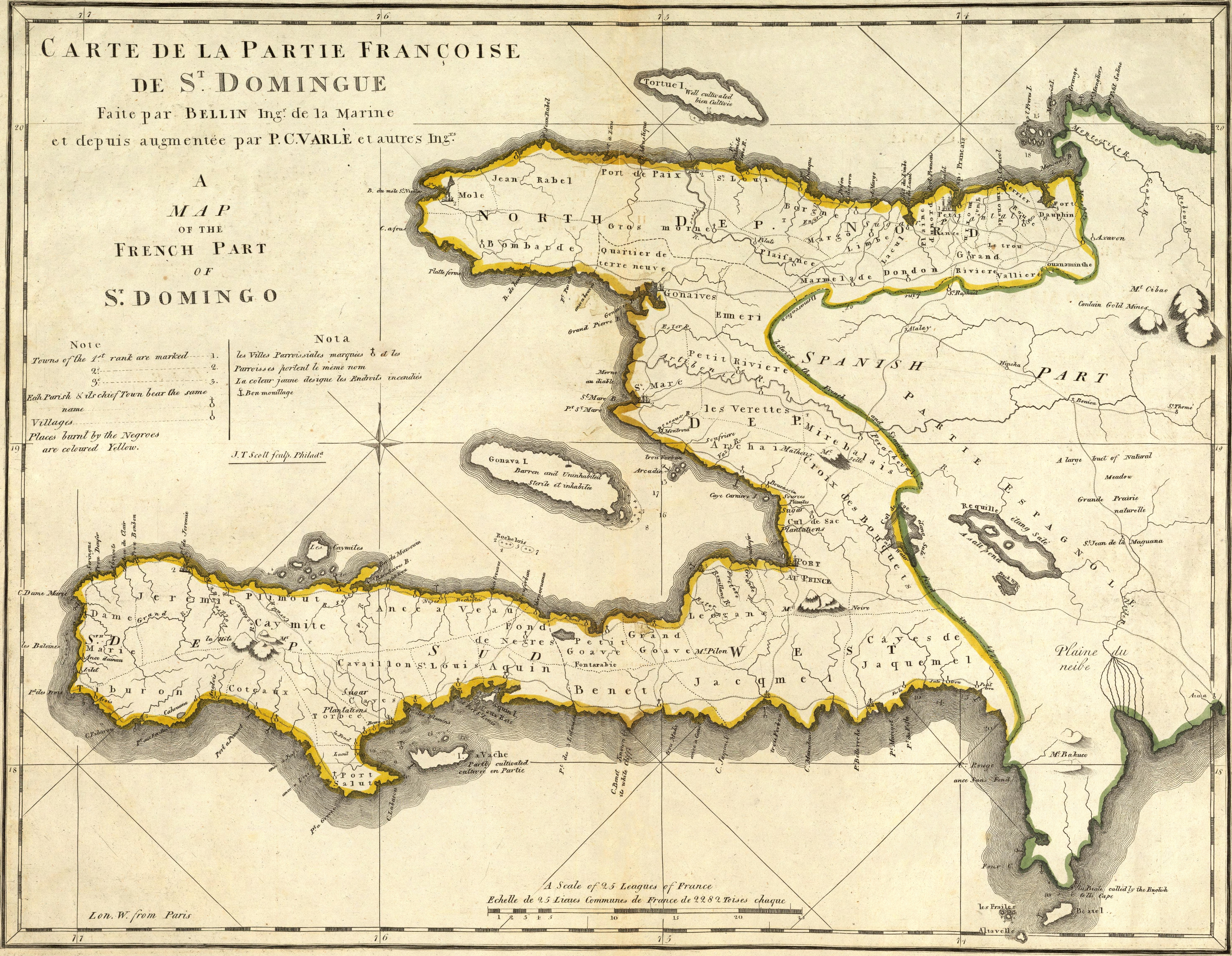
English:
Map of French part of Saint Domingue (Haiti).
Français :
Carte de la partie française de Saint-Domingue.
|
| Date | |
| Source | https://www.davidrumsey.com/luna/servlet/detail/RUMSEY~8~1~640~50079:Carte-De-La-Partie-Francoise-De-St-?sort=Pub_List_No_InitialSort%2CPub_Date%2CPub_List_No%2CSeries_No# |
| Author | Mathew Carey (engravers/printers: Bellin, Jacques Nicolas, 1703-1772; Scott, Joseph T.; Varle, P.C.) |
Licensing
|
|
This work is in the public domain in its country of origin and other countries and areas where the copyright term is the author's life plus 100 years or fewer . |
| This file has been identified as being free of known restrictions under copyright law, including all related and neighboring rights. | |