Sani_Pass_heading_into_Lesotho.jpg

Size of this preview:
800 × 532 pixels
.
Other resolutions:
320 × 213 pixels
|
640 × 425 pixels
|
1,024 × 680 pixels
|
1,280 × 850 pixels
|
1,600 × 1,063 pixels
.
Summary
| Description |
English:
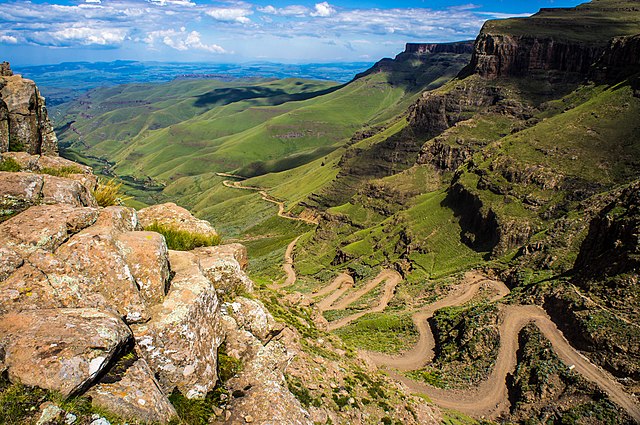
The road through
Sani Pass
taken from the rim of
Drakensberg Escarpment
within 100 metres of the South African/Lesotho border.
|
| Date | |
| Source | Flickr : Sani Pass |
| Author | Vaiz Ha |
| Camera location |
|
View this and other nearby images on: OpenStreetMap |
|
|---|
Geo-coords added by Martinvl after comparison of image with Google Earth .
Licensing
|
|
This image was originally posted to Flickr by Vaiz Ha at https://www.flickr.com/photos/93708644@N05/8523139565 . It was reviewed on 11 March 2015 by FlickreviewR and was confirmed to be licensed under the terms of the cc-by-2.0. |
This file is licensed under the
Creative Commons
Attribution 2.0 Generic
license.
Attribution:
Vaiz Ha
-
You are free:
- to share – to copy, distribute and transmit the work
- to remix – to adapt the work
-
Under the following conditions:
- attribution – You must give appropriate credit, provide a link to the license, and indicate if changes were made. You may do so in any reasonable manner, but not in any way that suggests the licensor endorses you or your use.

|
This image has been assessed under the valued image criteria and is considered the most valued image on Commons within the scope: Road up the Sani Pass , South Africa heading towards the Lesotho border. . You can see its nomination here . |