Satellite_image_of_Flevopolder,_Netherlands_(5.48E_52.43N).png

Size of this preview:
800 × 548 pixels
.
Other resolutions:
320 × 219 pixels
|
640 × 439 pixels
|
1,024 × 702 pixels
.
| Description |
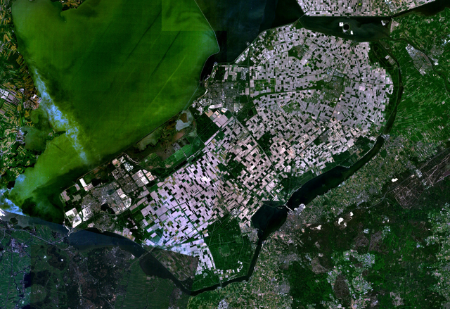
English:
Satellite image of the
Flevopolder
in the
Netherlands
. Technically, the Flevopolder consists of Zuidelijk Flevoland (Southern Flevoland), Oostelijk Flevoland (Eastern Flevoland) and the
Noordoostpolder
(North Eastern Polder). This image shows Southern and Eastern Flevoland.
|
| Source | Screenshot from NASA's World Wind |
| Author | Photograph: NASA |
|
|
This image is in the
public domain
because it is a screenshot from
NASA
’s globe software
World Wind
using a public domain layer, such as Blue Marble, MODIS, Landsat, SRTM, USGS or GLOBE.
|

|