Satellite_image_of_France_in_August_2002.jpg

Size of this preview:
780 × 600 pixels
.
Other resolutions:
312 × 240 pixels
|
624 × 480 pixels
|
999 × 768 pixels
|
1,280 × 985 pixels
|
2,560 × 1,969 pixels
|
5,200 × 4,000 pixels
.
| Description |
English:
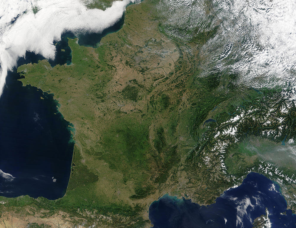
Satellite image of France acquired August 14, 2002, by the Terra satellite.
Suomi:
Satelliittikuva Ranskasta elokuussa 2002
|
| Date | |
| Source |
Slightly cropped image. Original taken from NASA's Visible Earth:
[1]
.
Credit: Jacques Descloitres, MODIS Rapid Response Team, NASA/GSFC |
| Author | Jacques Descloitres, MODIS Rapid Response Team, NASA/GSFC |
|
|
This file is in the public domain in the United States because it was solely created by NASA . NASA copyright policy states that "NASA material is not protected by copyright unless noted ". (See Template:PD-USGov , NASA copyright policy page or JPL Image Use Policy .) |
|

|
Warnings:
|
|
|
This image was selected as
picture of the day
on Wikimedia Commons for
4 May 2005
. It was captioned as follows:
English:
France
from space
Other languages:
Ænglisc
:
Francland
gesewen of woruldrúme
Bân-lâm-gú
:
Tùi thài-khong khoàⁿ
Hoat-kok
.
Català
:
França
des de l'espai.
Čeština
:
Francie
při pohledu z vesmíru
Cymraeg
:
Frainc
o'r gofod.
Deutsch
:
Frankreich
aus dem Weltraum gesehen
English
:
France
from space
Français
:
La
France
vue de l'espace.
Galego
:
Francia
Italiano
:
La
Francia
vista dal satellite.
Nederlands
:
Frankrijk
vanuit de ruimte.
Norsk bokmål
:
Frankrike
fra rommet
Polski
:
Francja z kosmosu
Slovenčina
:
Francúzsko
pri pohľade z vesmíru
Suomi
:
Elokuinen manner-
Ranska
satelliittikuvassa
Svenska
:
Satellitbild på
Frankrike
Беларуская
:
Францыя
з космасу
Български
:
Франция от космоса
Русский
:
Франция
из космоса
ไทย
:
ประเทศฝรั่งเศส
เมื่อมองจากอวกาศ
한국어
:
우주에서 바라본
프랑스
日本語
:
宇宙から見た
フランス
中文
:
法国
卫星照片
|