Scotland_Administrative_Map_1947.png
Size of this preview:
345 × 600 pixels
.
Other resolutions:
138 × 240 pixels
|
276 × 480 pixels
|
441 × 768 pixels
|
589 × 1,024 pixels
|
2,001 × 3,480 pixels
.
Summary
| Description |
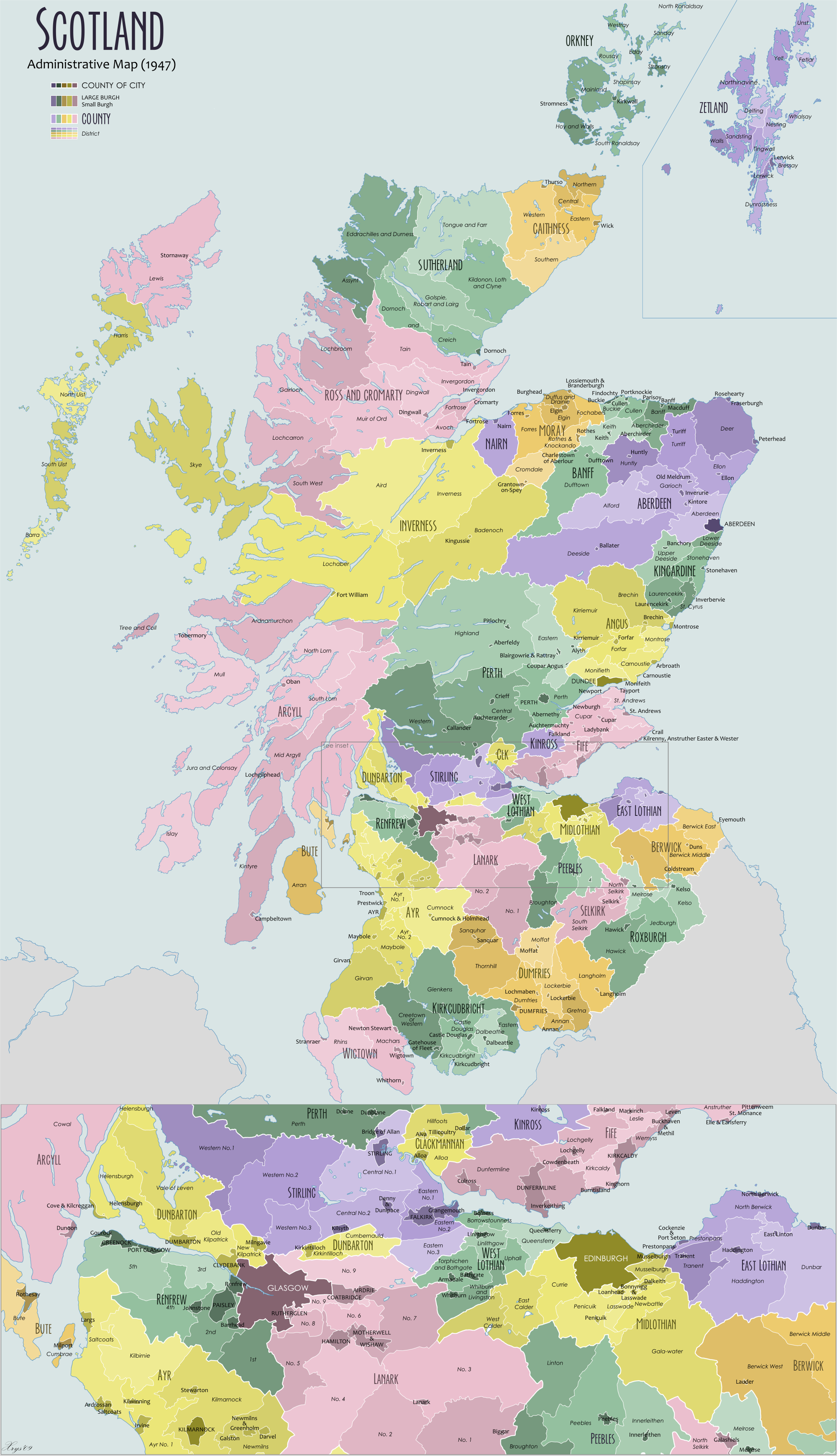
English:
Administrative map of Scotland in 1947. Showing counties and districts, counties of cities, large and small Burghs
|
| Date | |
| Source | Own work |
| Author | XrysD |
| Other versions |
Derivative works of this file: |
Licensing
I, the copyright holder of this work, hereby publish it under the following licenses:

|
Permission is granted to copy, distribute and/or modify this document under the terms of the GNU Free Documentation License , Version 1.2 or any later version published by the Free Software Foundation ; with no Invariant Sections, no Front-Cover Texts, and no Back-Cover Texts. A copy of the license is included in the section entitled GNU Free Documentation License . |
|
|
This file is licensed under the Creative Commons Attribution-Share Alike 3.0 Unported license. | |
|
||
| This licensing tag was added to this file as part of the GFDL licensing update . |
|
|
Copyleft: This work of art is free; you can redistribute it and/or modify it according to terms of the Free Art License . You will find a specimen of this license on the Copyleft Attitude site as well as on other sites . |
You may select the license of your choice.