Second_Congo_War_Africa_map_en.png
Size of this preview:
634 × 600 pixels
.
Other resolutions:
254 × 240 pixels
|
507 × 480 pixels
|
812 × 768 pixels
|
1,082 × 1,024 pixels
|
1,526 × 1,444 pixels
.
Summary

|
File:Second Congo War Africa map en.svg
is a vector version of this file. It should be used in place of this PNG file when not inferior.
File:Second Congo War Africa map en.png →
File:Second Congo War Africa map en.svg
For more information, see
Help:SVG
.
|

|
| Description |
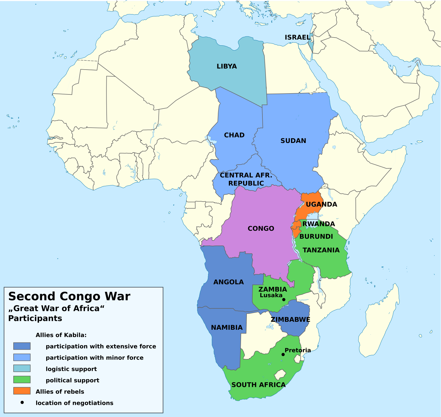
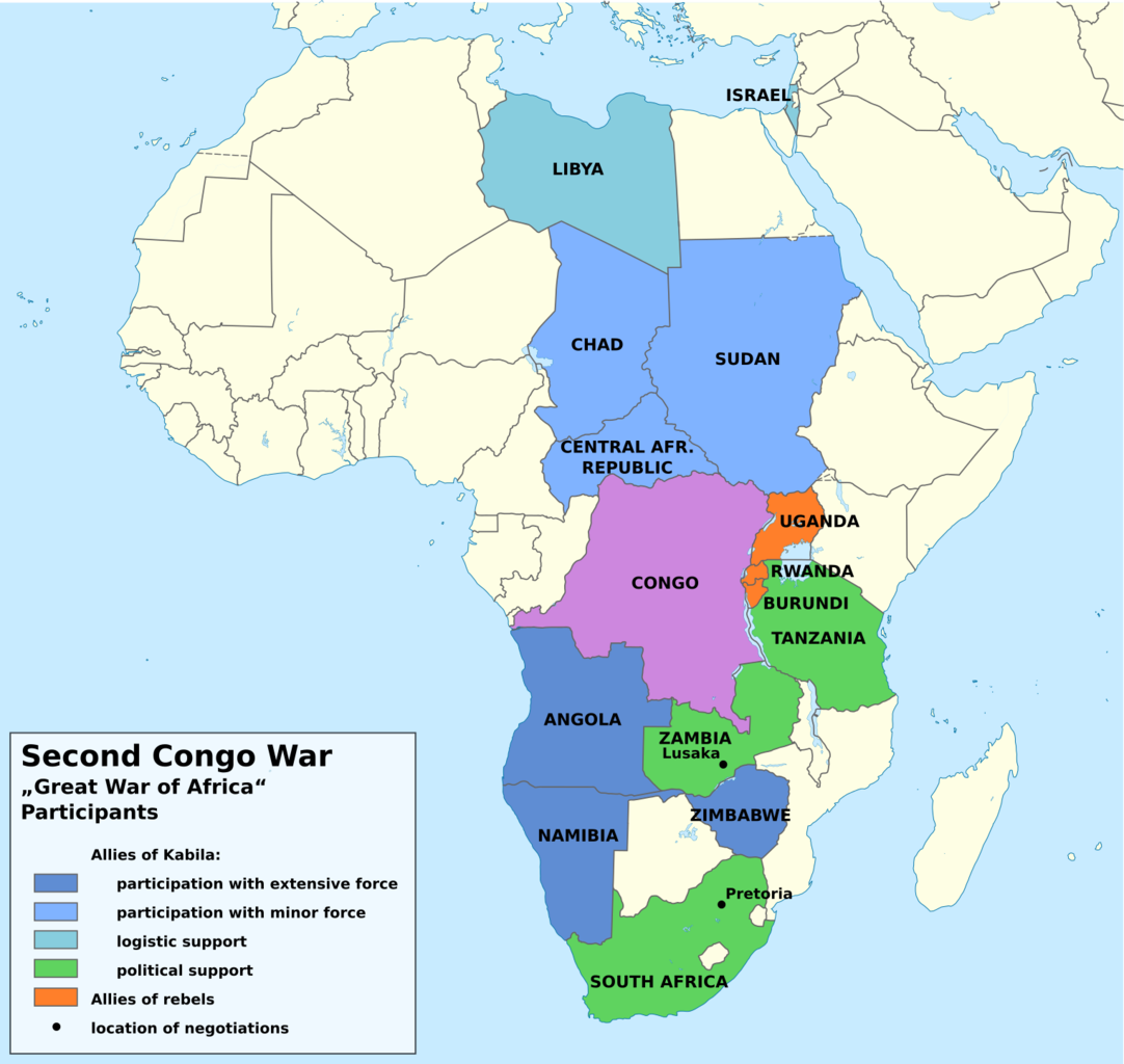
English:
Countries participating in the Second Congo War.
Deutsch:
Karte der Staaten, die am Zweiten Kongokrieg beteiligt waren.
|
| Date | |
| Source | Own work , based on File:Democratic Republic of the Congo in Africa (-mini map -rivers).svg |
| Author | Don-kun , TUBS |
| Other versions |


|
.svg)
Licensing
I, the copyright holder of this work, hereby publish it under the following licenses:

|
Permission is granted to copy, distribute and/or modify this document under the terms of the GNU Free Documentation License , Version 1.2 or any later version published by the Free Software Foundation ; with no Invariant Sections, no Front-Cover Texts, and no Back-Cover Texts. A copy of the license is included in the section entitled GNU Free Documentation License . |
This file is licensed under the
Creative Commons
Attribution 3.0 Unported
license.
-
You are free:
- to share – to copy, distribute and transmit the work
- to remix – to adapt the work
-
Under the following conditions:
- attribution – You must give appropriate credit, provide a link to the license, and indicate if changes were made. You may do so in any reasonable manner, but not in any way that suggests the licensor endorses you or your use.
You may select the license of your choice.