Serbia1817.png
Size of this preview:
800 × 578 pixels
.
Other resolutions:
320 × 231 pixels
|
640 × 462 pixels
|
863 × 623 pixels
.
Summary
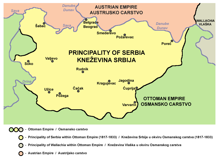
- Principality of Serbia in 1817.
- Kneževina Srbija 1817. godine.
Source and license

|
This map has been uploaded by
Electionworld
from en.wikipedia.org to enable the
|
Self-made map by PANONIAN
|
|
This work has been released into the
public domain
by its author,
PANONIAN
. This applies worldwide.
In some countries this may not be legally possible; if so:
|
References
- Školski istorijski atlas, Zavod za izdavanje udžbenika SR Srbije, Beograd, 1970.
- Povijesni atlas, Učila - Zagreb, Zagreb, 1971.
- Dr Tomislav Bogavac, Nestajanje Srba, Niš, 1994.
- Istorijski atlas, Intersistem Kartografija, Beograd, 2010.
- Istorijski atlas, Geokarta, Beograd, 1999.
- Sima M. Ćirković, Srbi među evropskim narodima, Beograd, 2004.
- Sve srpske mape - od šestog veka do Pariza, Specijalno izdanje BLICA, Decembar 1995. godine.
- The Times History of Europe, Times Books, London, 2002.
- http://terkepek.adatbank.transindex.ro/kepek/netre/99.gif
- http://www.znanje.org/i/i21/01iv04/01iv0418/images/knezevina_srbija_1.jpg
- http://www.znanje.org/i/i21/01iv04/01iv0418/images/knezevina_srbija_3.jpg
- http://www.zum.de/whkmla/histatlas/balkans/Serbia%201813%20to%201918.gif
derivative works

|
File:Serbia1817.svg
is a vector version of this file. It should be used in place of this PNG file when not inferior.
File:Serbia1817.png →
File:Serbia1817.svg
For more information, see
Help:SVG
.
|

|