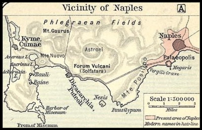
Shepherd-vicinity_of_Naples.jpg

Summary
| Description |
Italiano:
Mappa dello Shepherd (1911) sul golfo di Napoli e poi del litorale fino a Cumae
|
|||||
| Date | ||||||
| Source | File:Shepherd-c-030-031.jpg | |||||
| Author |
Historical Atlas by William R. Shepherd 1911 edition
Reference : Reference Map of Ancient Italy, Southern Part Courtesy of the University of Texas Libraries, The University of Texas at Austin. [1] |
|||||
|
Permission
( Reusing this file ) |
|
|||||

![[1]](http://www.lib.utexas.edu/maps/historical/shepherd/italy_ancient_south.jpg)
Original upload log
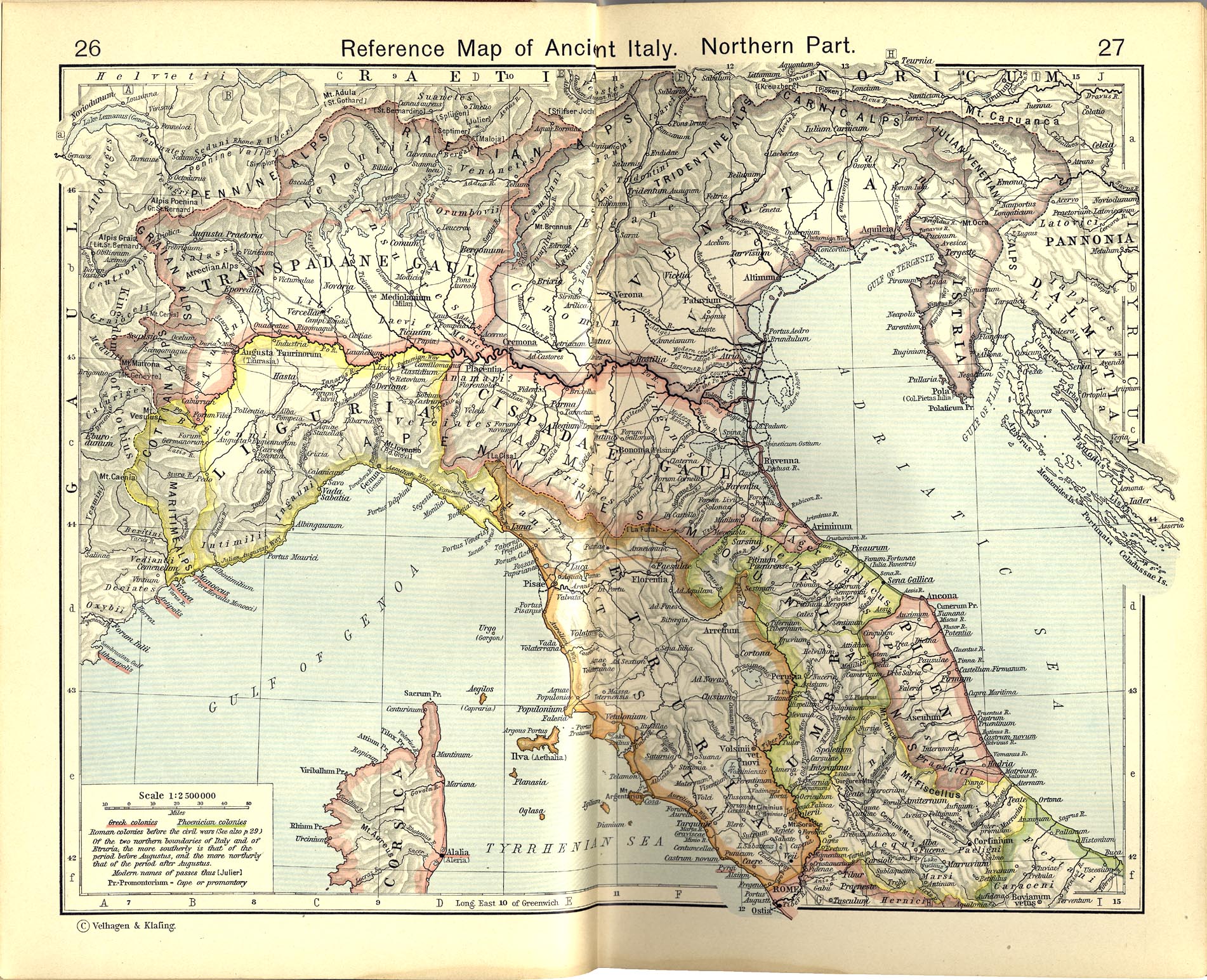
This image is a derivative work of the following images: File:Shepherd-c-030-031.jpg
10:05, 2007 July 1 user:Accurimbono . . (366 bytes) (+366) . . (== Summary == Map of South Italy during the Roman period. Extracted from The Historical Atlas by William R. Shepherd, 1911. Original image is at http://www.lib.utexas.edu/maps/historical/shepherd_1911/shepherd-c-026-027.jpg