Sinai-peninsula-map.jpg

Size of this preview:
483 × 600 pixels
.
Other resolutions:
193 × 240 pixels
|
387 × 480 pixels
|
941 × 1,168 pixels
.
فلسطين
Summary
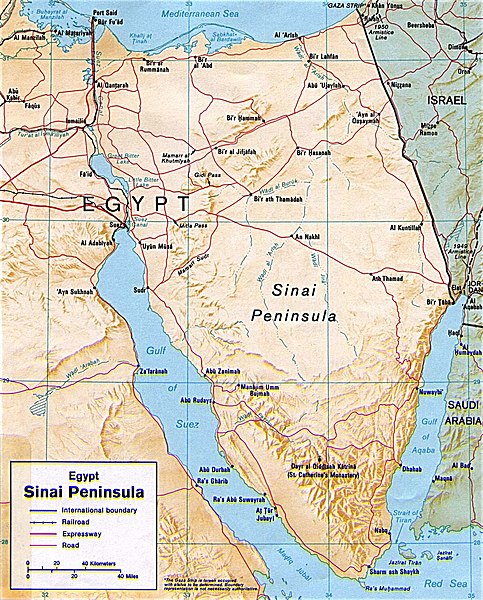
| Description | Shaded relief map of the Sinai Peninsula, 1992, produced by the U.S. Central Intelligence Agency. |
| Date | |
| Source | University of Texas Libraries, Perry-Castañeda Library Map Collection: Egypt Maps |
| Author | CIA |
| Other versions |
|


Licensing
|
|
This image is a work of a
Central Intelligence Agency
employee, taken or made as part of that person's official duties. As a Work of the United States Government, this image or media is in the
public domain
in the United States.
|

|