Skagen_aka_the_skaw_northmost_point_of_denmark_6th_may_2006.jpg
Size of this preview:
800 × 530 pixels
.
Other resolutions:
320 × 212 pixels
|
640 × 424 pixels
|
1,024 × 678 pixels
|
1,280 × 848 pixels
|
3,038 × 2,012 pixels
.
Summary
| Description |
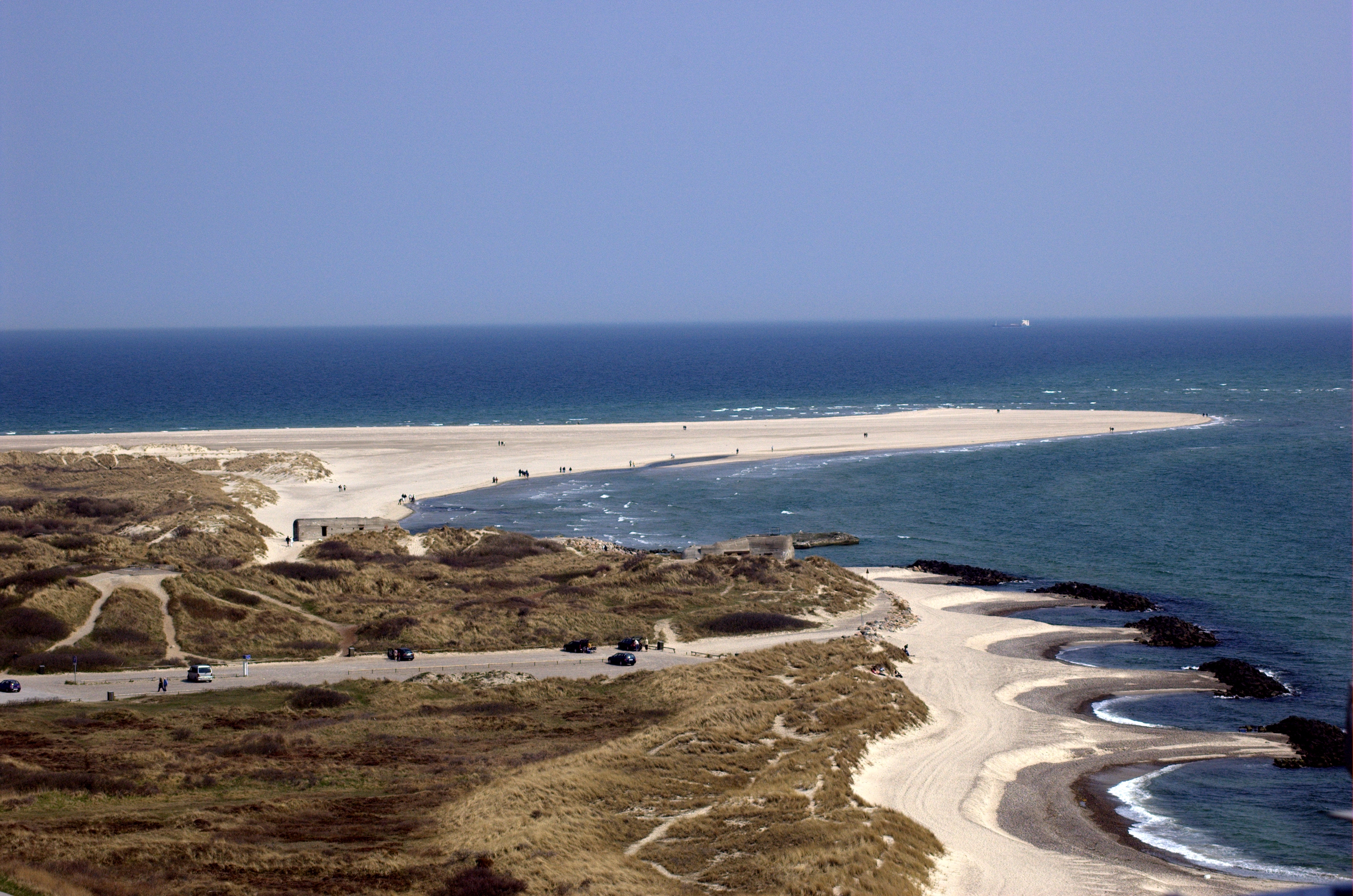
This is the northmost point of Jylland, Denmark. The very northmost projection of land is called Grenen in Danish, and the general area is, just as the nearby town, called Skagen (the area is sometimes also referred to as The Skaw in English). Location: Shot from the top of the Skagen lighthouse located just north of Skagen city. Camera: Nikon D50 using a 70-300mm lens (at 70mm when the photo was taken). |
| Date | |
| Source | Own work |
| Author | Martin Olsson (mnemo on en/sv wikipedia and commons, [email protected]). |
|
Permission
( Reusing this file ) |
This image is published on Wikipedia Commons by Martin Olsson under the GNU Free Documentation License (GFDL). |
| Camera location |
|
View this and other nearby images on: OpenStreetMap |
|
|---|
Licensing
I, the copyright holder of this work, hereby publish it under the following licenses:

|
Permission is granted to copy, distribute and/or modify this document under the terms of the GNU Free Documentation License , Version 1.2 or any later version published by the Free Software Foundation ; with no Invariant Sections, no Front-Cover Texts, and no Back-Cover Texts. A copy of the license is included in the section entitled GNU Free Documentation License . |
|
|
This file is licensed under the Creative Commons Attribution-Share Alike 3.0 Unported license. | |
|
||
| This licensing tag was added to this file as part of the GFDL licensing update . |
You may select the license of your choice.