SotresPanorama.jpg


Summary

Description
Deutsch: 
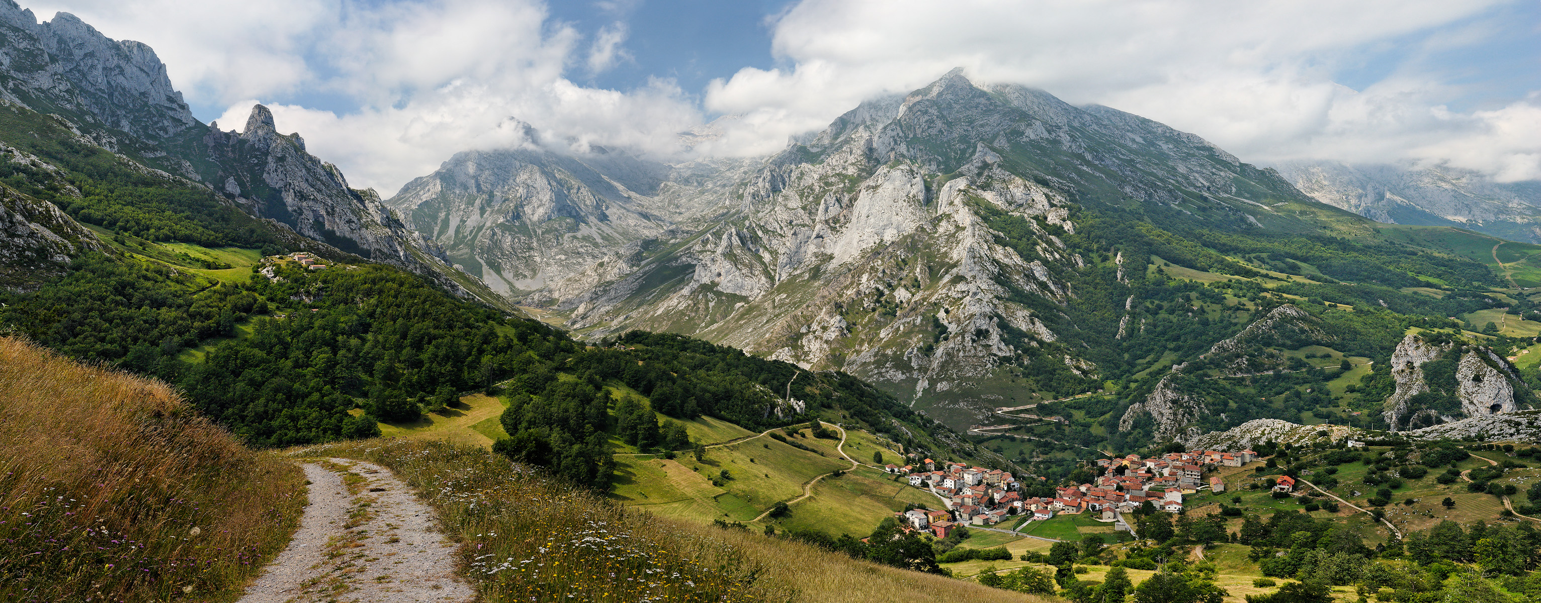
Das Bild zeigt das Dorf Sotres in Spanien. Im Hintergrund die Picos de Europa . (Es handelt sich hierbei um eine herunterskalierte Version eines aus sechs Einzelbildern zusammengesetzten Panoramas.)
English: The Central Massif of the Picos de Europa , showing the village of Sotres in Cabrales, Asturias, Spain.
This is a downsampled copy of a six-part 56Mb stitched panorama.
Français : Vue du massif central des Pics d'Europe ( Picos de Europa ), montrant le village de Sotres dans la commune asturienne de Cabrales , en Espagne .
Date Unknown date
Unknown date
(uploaded 2007-08-28)
Source Own work
Author Mick Stephenson mixpix
Permission
( Reusing this file )
See licence, attribution required
Other versions Derivative works of this file: Asturie banner.jpg
Camera location 43° 14′ 12.1″ N, 4° 44′ 20.8″ W Heading=236.25° Kartographer map based on OpenStreetMap. View this and other nearby images on: OpenStreetMap info


GNU head Permission is granted to copy, distribute and/or modify this document under the terms of the GNU Free Documentation License , Version 1.2 or any later version published by the Free Software Foundation ; with no Invariant Sections, no Front-Cover Texts, and no Back-Cover Texts. A copy of the license is included in the section entitled GNU Free Documentation License .
w:en:Creative Commons
attribution share alike
This file is licensed under the Creative Commons Attribution-Share Alike 3.0 Unported license.
You are free:
  • to share – to copy, distribute and transmit the work
  • to remix – to adapt the work
Under the following conditions:
  • attribution – You must give appropriate credit, provide a link to the license, and indicate if changes were made. You may do so in any reasonable manner, but not in any way that suggests the licensor endorses you or your use.
  • share alike – If you remix, transform, or build upon the material, you must distribute your contributions under the same or compatible license as the original.
This licensing tag was added to this file as part of the GFDL licensing update .

Image created by Mick Stephenson
This version has been released by me to Wikimedia under the GNU Free Documentation License v1.2 (see above)
A higher resolution version is available with the licence of your choice.
If you would like to use this image for commercial purposes and find either this version of the image or the terms of the GNU license in any way restrictive,
please contact me .
Any/all usage should be attributed as follows: Image: mickstephenson.photoshelter.com
Picture of the year
Picture of the year
Featured picture

Wikimedia Commons Wikipedia

This file was a candidate in Picture of the Year 2007 .
This is a featured picture on Wikimedia Commons ( Featured pictures ) and is considered one of the finest images. See its nomination here .

Wikipedia
This is a featured picture on the German language Wikipedia ( Exzellente Bilder ) and is considered one of the finest images. See its nomination here .
This is a featured picture on the English language Wikipedia ( Featured pictures ) and is considered one of the finest images. See its nomination here .
This is a featured picture on the Spanish language Wikipedia ( Recursos destacados ) and is considered one of the finest images. See its nomination here .

If you have an image of similar quality that can be published under a suitable copyright license , be sure to upload it, tag it, and nominate it .

Captions

Add a one-line explanation of what this file represents

Items portrayed in this file

depicts

43°14'12.098"N, 4°44'20.800"W

heading : 236.25 degree