South_Carolina_population_map.png
No higher resolution available.
| Description |
English:
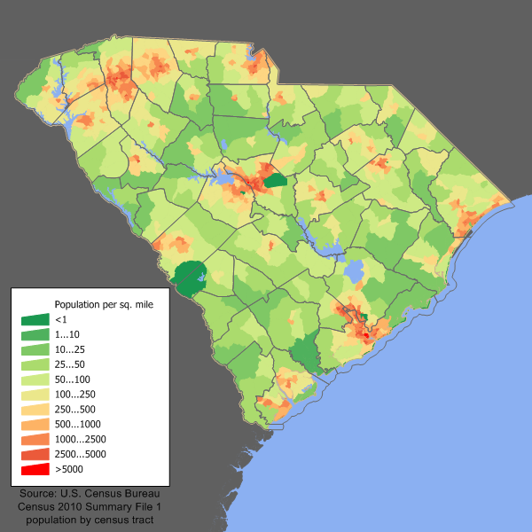
South Carolina population density map based on Census 2010. See the
data lineage
for a process description.
|
||||||||
| Date | 21 February 2006 (original upload date) | ||||||||
| Source | Transferred from en.wikipedia to Commons by Spyder_Monkey using CommonsHelper . | ||||||||
| Author | JimIrwin at English Wikipedia | ||||||||
|
Permission
( Reusing this file ) |
I, the copyright holder of this work, hereby publish it under the following license:
|

Original upload log
The original description page was
here
. All following user names refer to en.wikipedia.
- 2006-02-21 18:35 JimIrwin 700×525× (45112 bytes) South Carolina population density map based on Census 2000. See the [[User:JimIrwin/Lineage_of_population_maps|data lineage]] for a process description.