South_Orkney_Islands-en.svg

Size of this PNG preview of this SVG file:
800 × 476 pixels
.
Other resolutions:
320 × 190 pixels
|
640 × 381 pixels
|
1,024 × 609 pixels
|
1,280 × 761 pixels
|
2,560 × 1,523 pixels
|
2,303 × 1,370 pixels
.
Summary
| Description |
English:
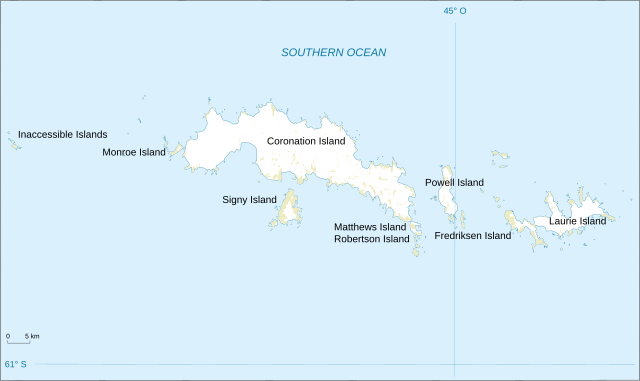
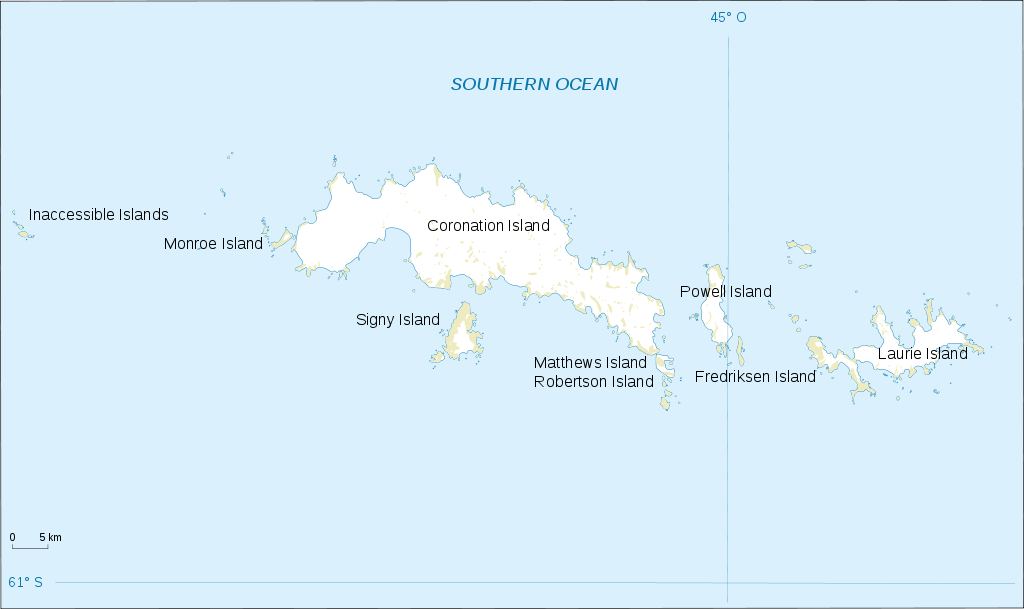
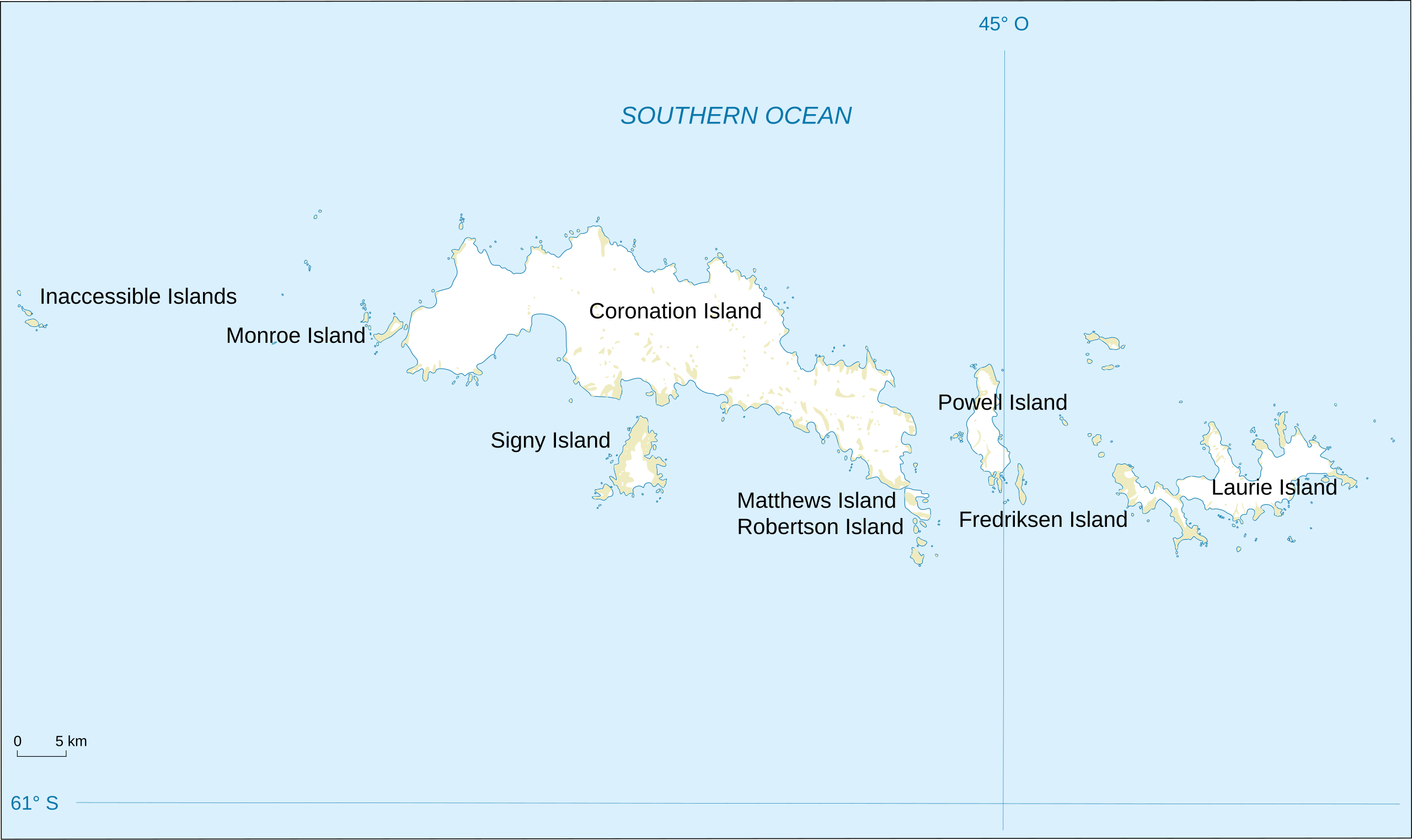
Map of South Orkney Islands.
Français :
Carte des Iles Orcades du Sud.
Italiano:
Mappa delle Isole Orcadi Meridionali.
|
| Date | |
| Source | Landsat Image Mosaic Of Antarctica (LIMA) |
| Author | Shakki |
| Other versions |
|


Licensing
|
|
This image is in the
public domain
in the United States because it only contains materials that originally came from the
United States Geological Survey
, an agency of the
United States Department of the Interior
. For more information, see
the official USGS copyright policy
.
|
|