SouthernCaribbeanIslands.PNG
Size of this preview:
800 × 405 pixels
.
Other resolutions:
320 × 162 pixels
|
840 × 425 pixels
.
Summary
| Description |
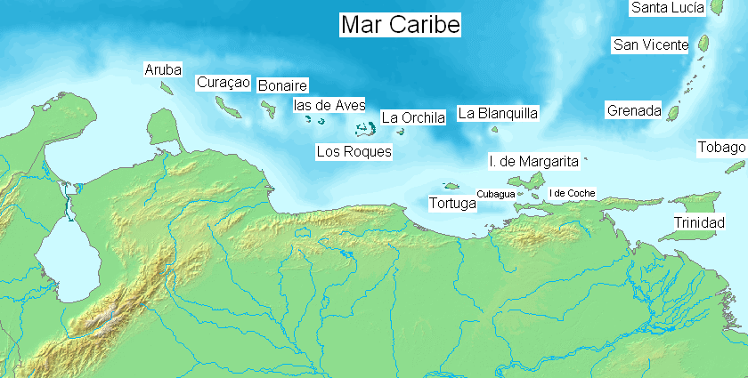
English:
Major islands of the southern
Caribbean Sea
.
Español:
Pricipales islas en el mar Caribe sur.
|
| Date | |
| Source | Own work ( Edited over former map File:Map of Venezuela Demis.png ) |
| Author | Claudio Elias |
|
|
This image is in the
public domain
because it came from the site
https://www.demis.nl/products/web-map-server/examples/
and was released by the
copyright
holder. Permission is granted to copy, distribute and/or modify this map since it is based on free of copyright images from:
www.demis.nl
. See also
approval email on de.wp
and
its clarification
.
|
|
|
This work has been released into the
public domain
by its
copyright
holder,
www.demis.nl
. This applies worldwide.
In some countries this may not be legally possible; if so: www.demis.nl grants anyone the right to use this work for any purpose , without any conditions, unless such conditions are required by law.
|
Licensing
|
|
I, the copyright holder of this work, release this work into the
public domain
. This applies worldwide.
In some countries this may not be legally possible; if so: I grant anyone the right to use this work for any purpose , without any conditions, unless such conditions are required by law. |