Stellardiagram-Zhengho.jpg
Size of this preview:
456 × 599 pixels
.
Other resolutions:
183 × 240 pixels
|
365 × 480 pixels
|
584 × 768 pixels
|
779 × 1,024 pixels
|
1,385 × 1,820 pixels
.
Summary
| Author |
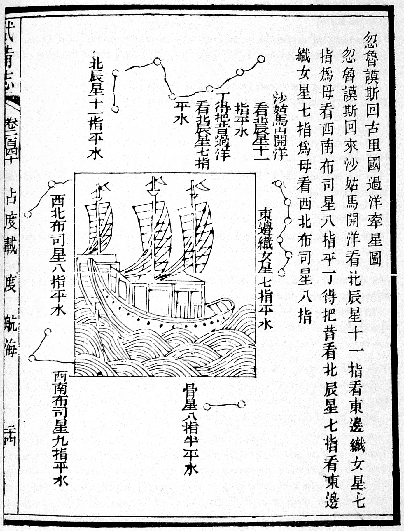
The author is unknown, but the charts were derived from works by Zheng He's expeditionary navigators during the early 15th century
|
| Description |
This navigational chart is one of the four stellar diagrams included in the
Wubei Zhi
, published in circa 1628. It appears in chapter 240, folio 24 r. The chart specifies the guiding stars enroute from Hormuz to Calicut.
|
| Source/Photographer | Not given by uploader |
| Other versions |
|
| Reference | Mills, J.V.G. (1970). Ying-yai Sheng-lan: 'The Overall Survey of the Ocean's Shores' [1433] . pp. 335–346. |

Licensing
|
|
This work is in the public domain in its country of origin and other countries and areas where the copyright term is the author's life plus 100 years or fewer . |
| This file has been identified as being free of known restrictions under copyright law, including all related and neighboring rights. | |