Stielers_Handatlas_1891_62_NE.jpg
Size of this preview:
600 × 600 pixels
.
Other resolutions:
240 × 240 pixels
|
480 × 480 pixels
|
768 × 768 pixels
|
1,250 × 1,250 pixels
.
| Description |
English:
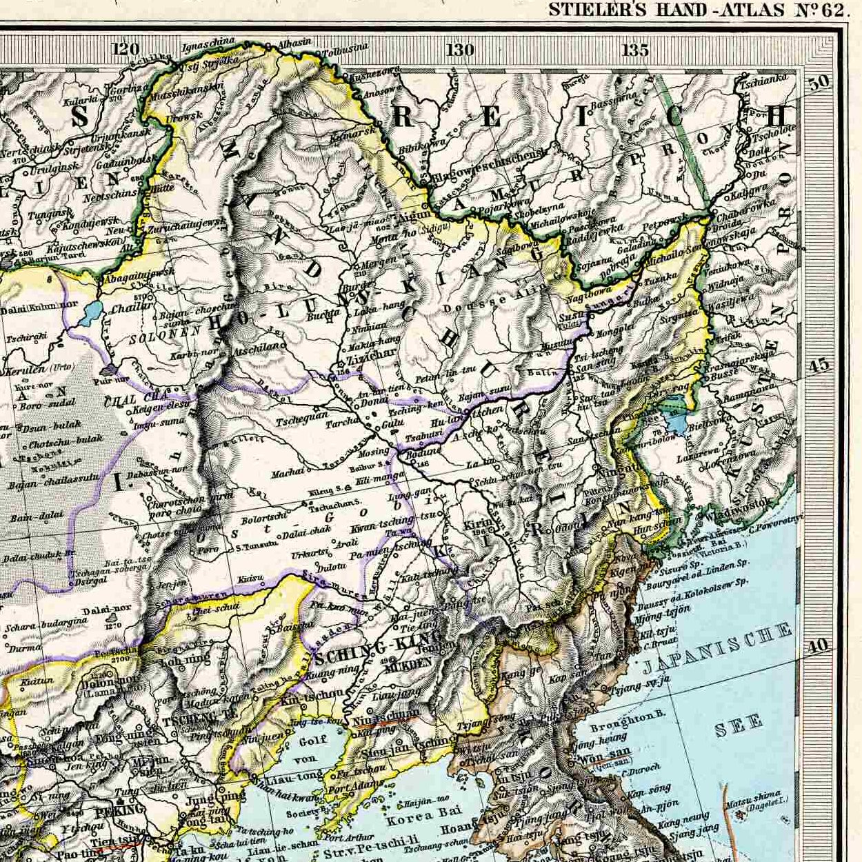
Northeastern corner of the 1892 map of China, for inclusion into articles about Manchuria.
|
| Date | (UTC) |
| Source | |
| Author |
|
| Other versions |
Entire map:

|
|
|
This is a
retouched picture
, which means that it has been digitally altered from its original version. Modifications:
Northeastern corner
. The original can be viewed here:
Stielers Handatlas 1891 62.jpg
:
|
|
|
The author died in Stielers Handatlas 1891, so this work is in the public domain in its country of origin and other countries and areas where the copyright term is the author's life plus 100 years or fewer . This work is in the public domain in the United States because it was published (or registered with the U.S. Copyright Office ) before January 1, 1929. |
| This file has been identified as being free of known restrictions under copyright law, including all related and neighboring rights. | |
Original upload log
This image is a derivative work of the following images:
-
File:Stielers_Handatlas_1891_62.jpg
licensed with PD-old, Stielers Handatlas 1891
- 2006-11-21T17:44:31Z Poccil 3863x3188 (1572611 Bytes) {{Stielers Handatlas 1891|61|63|Chinesisches Reich|Chinese Empire}} [[Category:Old maps of China]]
Uploaded with derivativeFX