Subcarpathia_Carpatho-Ukraine.svg

Size of this PNG preview of this SVG file:
688 × 525 pixels
.
Other resolutions:
315 × 240 pixels
|
629 × 480 pixels
|
1,007 × 768 pixels
|
1,280 × 977 pixels
|
2,560 × 1,953 pixels
.
Summary
| Description |
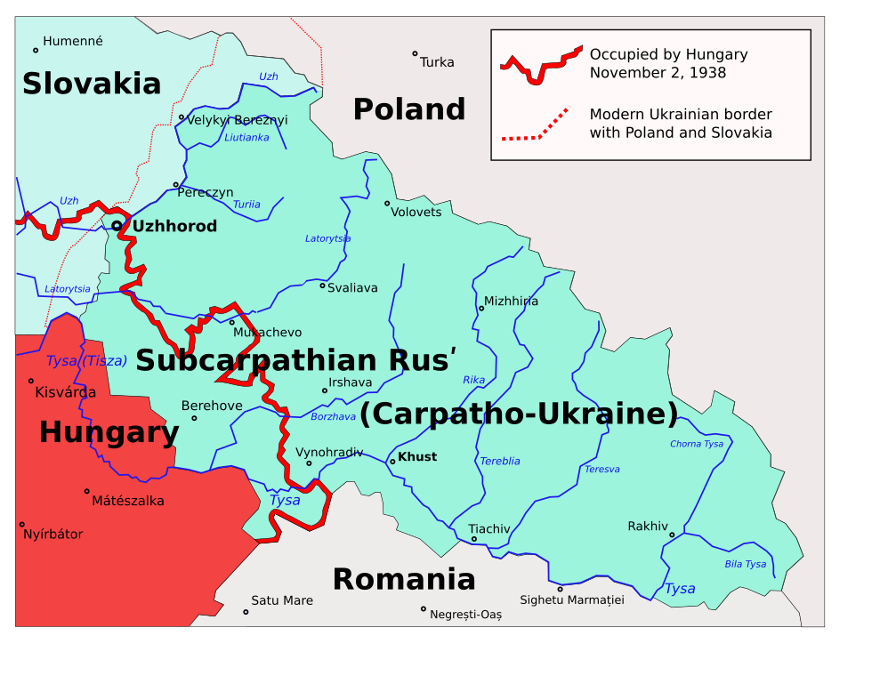
English:
Map of the
Subcarpathian Rus (1919-1938)
, that was an autonomous region of the first
Czechoslovak Republic
; later transformed into the
Carpathian Ukraine (1938-1939)
, that was an autonomous region of the second
Czechoslovak Republic
, and briefly a self-proclaimed independent state, in March 1939. Own work based on different printed and digital maps.
Polski:
Zakarpacie w latach 1938–1939.
|
| Date | 22 March 2006 (original upload date) |
| Source | No machine-readable source provided. Own work assumed (based on copyright claims). |
| Author | No machine-readable author provided. PM assumed (based on copyright claims). |
| Other versions |
|


derivative works
Derivative works of this file:
- Subcarpathia Carpatho-Ukraine uk.svg
- Subcarpathia Carpatho-Ukraine-es.svg
- Subcarpathia Carpatho-Ukraine be.svg
- Carpatho Ukraine March 1939.png
Licensing
|
|
I, the copyright holder of this work, release this work into the
public domain
. This applies worldwide.
In some countries this may not be legally possible; if so: I grant anyone the right to use this work for any purpose , without any conditions, unless such conditions are required by law. |