Superpower_map_1945.png

Size of this preview:
800 × 351 pixels
.
Other resolutions:
320 × 140 pixels
|
640 × 281 pixels
|
1,425 × 625 pixels
.
Legend

|
This
map
image could be re-created
using
vector graphics
as an
SVG
file
. This has several advantages; see
Commons:Media for cleanup
for more information. If an SVG form of this image is available, please upload it and afterwards replace this template with
{{

vector version available

|

new image name

}}
.
It is recommended to name the SVG file “Superpower map 1945.svg”—then the template Vector version available (or Vva ) does not need the new image name parameter. |
English
:
English
(en):
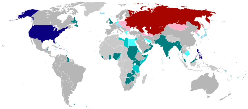
Map of the world in 1945 with dependencies in lighter shading and respective
superpowers
at the time.
British
Trust Territories
British
Postwar
Occupations
US postwar Occupations
Soviet postwar
Occupations
বাংলা
:
বাংলা
(bn):
১৯৪৫ সালের মানচিত্রে পরাশক্তি ও তাদের উপর নির্ভর রাষ্ট্রসমূহ
ব্রিটিশ সাম্রাজ্য
ব্রিটিশদের বিশ্বস্ত অঞ্চলসমূহ
যুক্তরাষ্ট্র
যুক্তরাষ্ট্র বিশ্বস্ত অঞ্চলসমুহ
সোভিয়েত ইউনিয়ন
|
|
This work has been released into the
public domain
by its author,
projectname
at
English Wikipedia
. This applies worldwide.
In some countries this may not be legally possible; if so: projectname grants anyone the right to use this work for any purpose , without any conditions, unless such conditions are required by law. |
.